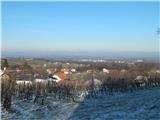
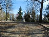
 | Cemetery Radenci - Viewpoint Kapela
Viewpoint Kapela is located next to the Church of St. Mary Magdalene on Kapelski Vrch. The viewpoint offers a beautiful view of the Slovenske gor...
25 min |
 | Selo (log cabin TIC Selo) - Makotrov breg
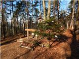
Makotrov breg is a 319-metre-high hill located along the marked Selo - Kančevci trail. At the top there is a table, benches and an information bo...
25 min |
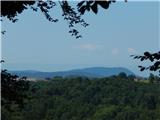
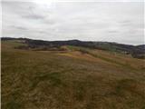 | Nuskova - Beli breg
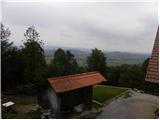
Beli breg is a 346-metre-high hill located in Goričko. The grassy peak offers a beautiful view, which, with good visibility, reaches all the way ...
30 min |
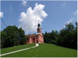
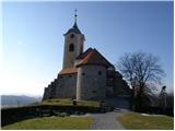
 | Gornji Petrovci (Dol) - Church of the Holy Trinity (Gornji Petrovci)
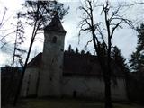
The Church of the Holy Trinity is located on a hill in Gornji Petrovci. From the top, you have a beautiful view of Goričko....
25 min |
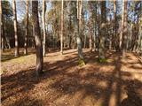
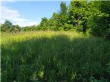
 | Trdkova - Zalka
Zalka is a 362-metre-high peak in Goričko, northeast of Kuzma. The peak is located in a forest, but still offers some views....
18 min |
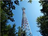 | Trdkova - Bogin breg
Bogin breg is a 371-metre-high hill located between Dolice and Trdkovo. The forest on top of the transmitter gives you a better view....
25 min |
 | Dragomer - Liparjev grič (via Lukovica)
Liparjev grič is the grassy hill above Dragomer. It is located a few steps away from the marked path leading from Dragomer towards Ključ and Debe...
20 min |
 | Trdkova - Tromejnik / Dreiländerecke / Harmashatar (Ježkova pot - by road)
Tromejnik, Dreiländerecke in German or Hármashatár in Hungarian, is a 390 m high hill located on the tri-border between Slovenia, Austria and Hun...
20 min |
 | Trdkova - Tromejnik / Dreiländerecke / Harmashatar (on marked path through the forest)
Tromejnik, Dreiländerecke in German or Hármashatár in Hungarian, is a 390 m high hill located on the tri-border between Slovenia, Austria and Hun...
20 min |
 | Oberdrosen - Tromejnik / Dreiländerecke / Harmashatar
Tromejnik, Dreiländerecke in German or Hármashatár in Hungarian, is a 390 m high hill located on the tri-border between Slovenia, Austria and Hun...
30 min |
 | Rožna dolina - Cankarjev vrh (Rožnik) (by road)
Cankarjev vrh is a 394 m high peak located to the east of the Ljubljana Zoo. From the top of the hill, where the church and the restaurant are si...
20 min |
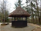
 | Dragomer (bajer) - Ferjanka
Ferjanka je priljubljena izletniška točka, ki leži nad Logom in Dragomer pri Brezovici ter Brezjem v dolini reke Horjulščice. Na vrhu je brunaric...
20 min |
 | Ljubljana (Podgorica pri Črnučah) - Oljska gora
Oljska gora is a 401 metre high hill in the north of Ljubljana, between Nadgorica, Podgorica and Dragomlje. At the top there is a registration bo...
20 min |
 | Selnica ob Dravi - Sv. Janez Krstnik (Janževa Gora)
...
20 min |
 | Preserje - Žalostna gora at Preserje
Žalostna gora at Preserje is a 418-metre-high hill located above Prevalje pod Krimom and Kamnik under the Krim. On the top stands the Church of t...
30 min |
 | Gorjuša - Veliki vrh (Križentaver)
Veliki vrh, or Križentaver, is a 419-metre-high hill located above Ihan. There is no better view from the top, where there is a registration box ...
20 min |
 | Podolnica - Sveti Urh (above Zaklanec)
The Sveti Urh Church is situated on a small lookout between Zaklanc and Podolnica. The church offers a beautiful view of the hills above the Ljub...
25 min |
 | Koseze - Debeli vrh (above Topole)
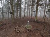
Debeli vrh is a forested peak located between Koseze and Topole. At the top of the peak is a small wooden cross attached to the trunk of a tree....
25 min |
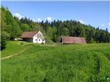
 | Podvin pri Polzeli - Vinski vrh (Vimperk) (on footpath)
Vinski vrh or Vimperk is an peak located north of Polzela. On the top stands the Church of St. Nicholas, and next to it is a small house that use...
18 min |