 | Polhov Gradec - Polhograjska Grmada (via Ravnek and via Sveta Uršula)
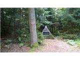
Polhograjska Grmada is an 898 m high peak located in the heart of the Polhograjski Dolomiti. The summit, which has a registration box with a stam...
1 h 50 min |
 | Rakovnik - Sveti Jakob (via Breznik)
The Church of St James is located on a hill north of the village of Topol near Medvode. From the top, where there is a registration box with a st...
1 h 50 min |
 | Sveta Barbara (Nova Hrastnica) - Sveti Ožbolt (above Zminec)
Sveti Ožbolt is located on a scenic peak in the north of the Polhograjske Dolomites. It has a beautiful view of the Škofjeloško hribovje and part...
1 h 40 min |
 | Dorfarje - Archangel Gabriel (Planica)
Planica is an 824 m high peak located north of Škofja Loka, between Krizna Gora and Planica. From the top, where the Church of St. Gabriel the Ar...
2 h |
| Vešter - Archangel Gabriel (Planica)
Planica is an 824 m high peak located north of Škofja Loka, between Krizna Gora and Planica. From the top, where the Church of St. Gabriel the Ar...
2 h 20 min |
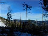
 | Stara baba - Sinji vrh
Sinji vrh is a scenic mountain located between Col, Ajdovščina and Predmeja. From the top, you can enjoy a beautiful view over most of western Sl...
1 h 45 min |
 | Divje jezero - Hleviška planina (via Strug)
Hleviška planina (also Hleviška planina) is a slightly overgrown but still very scenic peak. From the top, which is the house mountain of Idrija,...
1 h 45 min |
 | Spodnje Stranice (graves of hundred hostages) - Stolpnik (by road)
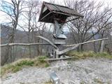
At 1012 m, Stolpnik is the highest peak of the Konjiška Gora, a mountain range stretching south-west from Slovenske Konjice. A 25 m high lookout ...
2 h |
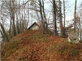
 | Slavkov dom na Golem Brdu - Rog
The Rog is a 798 m high peak located above the village of Topole, just 10 minutes from St Catherine's Church. From the top of the hill, where a l...
1 h 40 min |
 | Selca - Miklavška gora (by road)
Miklavška gora is a lookout located south of Železniki and Selce. From the top of the hill on which the Church of St Nicholas stands, we have a b...
1 h 45 min |
 | Jamce - Kovk
Kovk is a scenic peak located to the west of Cola, on a jagged ridge rising steeply above the Vipava valley. From the top with a cross, we have a...
2 h 10 min |
 | Zgornja Kungota - Tojzlov vrh
Tojzlov vrh is a forested hill located in the eastern part of Kozjak. On the top of the hill stands a small stone monument to the National Libera...
2 h 30 min |
 | SSK Sam Ihan - Murovica (via Dobovlje)
Murovica is a popular excursion point, accessible from the Posavina side, Domžale or from the Moravška valley. There is a bench and a registratio...
2 h 40 min |
 | Vitovlje - Hunting cottage below Čaven
The hunting shelter is located on a lookout on the side ridge of the Čavna. The shelter, which serves as an emergency bivouac, offers a beautiful...
1 h 50 min |
 | Zgornja Rečica (Maček) - Govško brdo (mimo pastirske kapelice)
Govško brdo is an 811m high hill located west of the village of Huda jama above Laško. From the top of the hill, where the registration box and s...
1 h 35 min |
 | Zabočevo - Novaška gora
Novaška gora is a forested peak located west of Rakitna....
2 h |
 | Source of Ljubljanica (Močilnik) - Ljubljanski vrh
Ljubljanski vrh is an 819 m high hill located south of Vrhnika. The army has a radar observatory on the top, so it is not possible to climb to th...
2 h |
 | Polhov Gradec - Mala Grmada (via Ravnek and via Sveta Uršula)
Mala Grmada is an 853 m high peak located south-west of the slightly higher Polhograjska Grmada. From the top, you have a beautiful view over the...
1 h 35 min |
 | Spodnja Idrija - Gradišče (above Spodnja Idrija) (via Grič)
Gradišče is a 998-metre-high peak that separates the Ledine plateau in the north-western part of the Rovtarski hills from the Idrijca valley. A t...
2 h |
 | Spodnja Idrija - Gradišče (above Spodnja Idrija) (via Trnje)
Gradišče is a 998-metre-high peak that separates the Ledine plateau in the north-western part of the Rovtarski hills from the Idrijca valley. A t...
2 h 15 min |
 | Žovneško jezero - Vrhe
Vrhe is a forested peak located to the east of the Church of the Holy Mother of God in Čreta. There is no view from the top due to the forest....
2 h 25 min |
 | Zazid - Golič (direct way)
Golič is a grassy ridge stretching from Kojnik to the Slovenian-Croatian border and continuing to Žbevnica on the Croatian side. Due to the relat...
1 h 45 min |
 | Selca - Sveti Mohor (Zabrekve)
The Church of St. Mohor is situated on a 952 m high hill, between Zgornja Besnica and Selce. From the church, or its immediate surroundings, we h...
1 h 40 min |
 | Knape - Sveti Mohor (Zabrekve) (via Hudi Laz, Flandrova pot)
The Church of St. Mohor is situated on a 952 m high hill, between Zgornja Besnica and Selce. From the church, or its immediate surroundings, we h...
1 h 40 min |
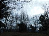
 | Cerkno - Veliki vrh (Lajše) (on unmarked path)
Veliki vrh is an almost 900 m high peak rising south of Cerkno. From the top, where there are several television and radio transmitters covering ...
1 h 40 min |
| Straža - Želin - Veliki vrh (Lajše)
Veliki vrh is an almost 900 m high peak rising south of Cerkno. From the top, where there are several television and radio transmitters covering ...
2 h |
 | Cerkno - Škofje (on unmarked path)
Škofje is a 973 m high peak located above the villages of Čeplez, Planina pri Cerknem and Podpleče. The peak itself, on which stands a small conc...
1 h 45 min |
 | Bottom station of Pohorje cable car - Pečke (via Meranovo)
Pečke is an easily accessible and recently less and less visited peak located north of the main ridge of Pohorje. It receives more visitors only ...
2 h |
 | Jamce - Sončnica (Reber)
Sončnica is a paragliding airstrip on the outskirts of the Gora plateau or Reber Ridge. There are a few benches, an automatic weather station Kov...
1 h 45 min |
 | Poljana - Andrejev vrh (over Volinjak and on cart track)
Andrejev vrh is a forested peak located between Mežica and Lesa. There is a bench on the top and a registration box with a registration book....
1 h 50 min |
| Poljana - Andrejev vrh (via Volinjak and past the chapel)
Andrejev vrh is a forested peak located between Mežica and Lesa. There is a bench on the top and a registration box with a registration book....
1 h 55 min |
| Poljana - Andrejev vrh (past Leše churches and on cart track)
Andrejev vrh is a forested peak located between Mežica and Lesa. There is a bench on the top and a registration box with a registration book....
1 h 50 min |
| Poljana - Andrejev vrh (via Leše churches and via chapel)
Andrejev vrh is a forested peak located between Mežica and Lesa. There is a bench on the top and a registration box with a registration book....
1 h 55 min |
 | Selca - Sleme (Površnica)
Sleme is a scenic peak located between Rudni, Dražgoše and Lajša. The summit, where the transmitters are located, offers a beautiful view of the ...
1 h 35 min |
| Železniki - Sleme (Površnica) (via Štalca)
Sleme is a scenic peak located between Rudni, Dražgoše and Lajša. The summit, where the transmitters are located, offers a beautiful view of the ...
1 h 35 min |
 | Pravdan - Tolsta gora (via Čeh)
Tolsta gora is a 734-metre-high mountain located above Vrhpolje near Kamnik. From the top, where cairn stands, there is no better view, thanks to...
1 h 45 min |
 | Pravdan - Vrtače (via Zgornje Palovče)
Vrtače is a 758-metre-high peak located above the village of Zgornje Palovče. The peak is covered with forest, but the clearing slightly below th...
1 h 45 min |
 | Hotavlje - Špik (Vranškov grič) (via Bela)
Špik, also known as Vranškov grič on maps, is a 908 m high mountain located west of Hotavlje. The peak is located in a forest, but the grassy for...
1 h 50 min |
| Podgora - Špik (Vranškov grič)
Špik, also known as Vranškov grič on maps, is a 908 m high mountain located west of Hotavlje. The peak is located in a forest, but the grassy for...
1 h 45 min |
 | Hotavlje - Kucelj (above Kopačnica) (via village Studor)
Kucelj is a 920-metre-high peak located above the left bank of the Kopačnica and above the village of the same name. On the top there is a bench,...
2 h 10 min |
| Hotavlje - Kucelj (above Kopačnica) (via Srednje Brdo)
Kucelj is a 920-metre-high peak located above the left bank of the Kopačnica and above the village of the same name. On the top there is a bench,...
1 h 55 min |
 | Bresternica (Spodnji Rušnik) - Možičev vrh (via Žavcarjev vrh)
Možičev vrh is a 926 m high peak located to the west of the better known, but slightly lower, Žavcar Peak. There is a track leading to the summit...
1 h 55 min |
| Jelovec - Možičev vrh
Možičev vrh is a 926 m high peak located to the west of the better known, but slightly lower, Žavcar Peak. There is a track leading to the summit...
2 h 40 min |
 | Ožbalt (jez na potoku Črmenica) - Grilov vrh (po kolovozu)
...
1 h 40 min |
 | Selnica ob Dravi - Janžev vrh
...
1 h 35 min |
| Janževa Gora - Janžev vrh (mimo cerkve sv. Janeza Krstnika)
...
1 h 35 min |
 | Janževa Gora - Kranjčeva pečina (mimo cerkve sv. Janeza Krstnika)
...
2 h 10 min |
 | Muta (Zgornja Muta) - Napečnikov vrh
...
2 h 10 min |
 | Šentjanž pri Dravogradu - Selovec (Gruberjev vrh) (po jugovzhodnem grebenu)
...
2 h |
| Šentjanž pri Dravogradu - Selovec (Gruberjev vrh) (mimo Čubeja in Rudofa)
...
1 h 45 min |
| Šentjanž pri Dravogradu - Selovec (Gruberjev vrh) (mimo Napotnika in Rudofa)
...
1 h 45 min |