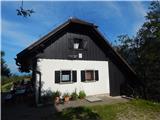
 | Preddvor - Planinska koča Iskra na Jakobu (on marked path)
The hut is situated below the top of Potoska Gora. There is a beautiful view of the Julian Alps and the Gorenjska plain. The hut is open every da...
1 h 30 min |
 | Preddvor - Planinska koča Iskra na Jakobu (via Planinska koča pri Franciju)
The hut is situated below the top of Potoska Gora. There is a beautiful view of the Julian Alps and the Gorenjska plain. The hut is open every da...
1 h 35 min |
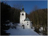 | Gornji Grad - Sveti Lenart above Gornji Grad
The Church of St Lenart above Gornji Grad, is located at the edge of a large meadow, more precisely on the slopes below Lepenatka and Rogatec. A ...
1 h 35 min |
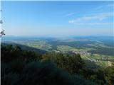 | Preddvor - Planinska koča pri Franciju (on marked path)
The cottage is located just a few dozen metres below the Church of St James above Preddvor. From the hut you have a beautiful view to the west an...
1 h 30 min |
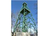 | Zgornje Poljčane - Boč (via Baba)
Karavanke just pass overBoč, Donačka gora and Macelj slowly to the Panonian valley...
1 h 45 min |
 | Zgornje Poljčane - Boč (via Balunjača)
Karavanke just pass overBoč, Donačka gora and Macelj slowly to the Panonian valley...
1 h 35 min |
 | Studenice - Boč (by road)
Karavanke just pass overBoč, Donačka gora and Macelj slowly to the Panonian valley...
2 h |
 | Zgornje Poljčane - Boč (on road and Senčna pot)
Karavanke just pass overBoč, Donačka gora and Macelj slowly to the Panonian valley...
1 h 50 min |
 | Zgornja Kostrivnica - Boč
Karavanke just pass overBoč, Donačka gora and Macelj slowly to the Panonian valley...
2 h |
 | Zgornja Kostrivnica - Boč (via Koča Velikonočnica)
Karavanke just pass overBoč, Donačka gora and Macelj slowly to the Panonian valley...
2 h |
 | Hotavlje - Koča na Ermanovcu (by road)
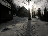
The hut is located north-west of Ermanovec, below the summit of Štora. From the hut or the surrounding area there is a beautiful view to the west...
2 h 10 min |
 | Gradišče - Koča pod Kremžarjevim vrhom
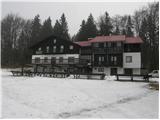
The hut is located to the west of Kremžarjev vrh, which is only a few minutes' walk away. From the hut, which is a point on the Slovenian mountai...
1 h 45 min |
 | Slovenj Gradec - Koča pod Kremžarjevim vrhom
The hut is located to the west of Kremžarjev vrh, which is only a few minutes' walk away. From the hut, which is a point on the Slovenian mountai...
2 h 5 min |
 | Hrastnik - Planinski dom na Kalu (via Klobuk)
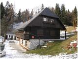
Planinski rudarski dom na Kalu is located below the summit of Kala (985 m). Near the house is a large meadow, which offers a beautiful view of th...
2 h 15 min |
 | Hrastnik - Planinski dom na Kalu (via Ravne)
Planinski rudarski dom na Kalu is located below the summit of Kala (985 m). Near the house is a large meadow, which offers a beautiful view of th...
2 h 15 min |
 | Dol pri Hrastniku - Planinski dom na Kalu
Planinski rudarski dom na Kalu is located below the summit of Kala (985 m). Near the house is a large meadow, which offers a beautiful view of th...
2 h |
 | Hrastnik - Planinski dom na Kalu (via Blate)
Planinski rudarski dom na Kalu is located below the summit of Kala (985 m). Near the house is a large meadow, which offers a beautiful view of th...
2 h 10 min |
 | Širje - Koča na Kopitniku
The hut is located north-east of Kopitnik, after which it was named. From the hut in front of which there are many tables and benches, there is a...
1 h 30 min |
 | Marno - Koča na Kopitniku
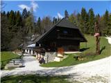
The hut is located north-east of Kopitnik, after which it was named. From the hut in front of which there are many tables and benches, there is a...
1 h 30 min |
 | Vransko - Dom na Čreti
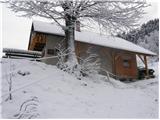
Dom na Čreti is located to the north of Vransko in the central part of the Dobrovel Plateau. There are also two churches close to the home, 5 and...
1 h 45 min |
 | Kokarje (ŠRC Laze) - Dom na Čreti (via Tajna)
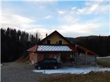
Dom na Čreti is located to the north of Vransko in the central part of the Dobrovel Plateau. There are also two churches close to the home, 5 and...
1 h 40 min |
 | Kokarje (ŠRC Laze) - Dom na Čreti (via Dom na Farbanci)
Dom na Čreti is located to the north of Vransko in the central part of the Dobrovel Plateau. There are also two churches close to the home, 5 and...
2 h |
 | Potok (Mostni graben) - Dom na Čreti (via Dom na Farbanci)
Dom na Čreti is located to the north of Vransko in the central part of the Dobrovel Plateau. There are also two churches close to the home, 5 and...
1 h 35 min |
 | Idrija - Koča na Hleviški planini (hunting path)
Koča na Hleviški planini is located just below the 908 m high peak Hleviše mountain pasture. From the hut, which is a point on the Slovenian Alpi...
1 h 35 min |
 | Idrija - Koča na Hleviški planini (via Kodrov rovt)
Koča na Hleviški planini is located just below the 908 m high peak Hleviše mountain pasture. From the hut, which is a point on the Slovenian Alpi...
1 h 50 min |
 | Pivola (Reka) - Mariborska koča (via Hočka koča)
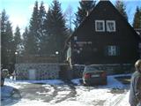
Mariborska koča is the first SPP control point. It is located north of Slivnik and west of Hoča Pohorje. As the vicinity of the hut is surrounded...
2 h 15 min |
 | Pivola (Reka) - Mariborska koča (via Petkovo sedlo)
Mariborska koča is the first SPP control point. It is located north of Slivnik and west of Hoča Pohorje. As the vicinity of the hut is surrounded...
2 h 15 min |
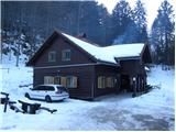 | Kočevje - Koča pri Jelenovem studencu (Grajska way)
Koča pri Jelenovem studencu is located south-west of Kočevje on the slopes of the forested Stojna. The cottage takes its name from the nearby Jel...
1 h 30 min |
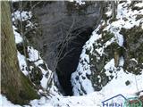 | Kočevje - Ledena jama on Stojna (Kalan way)
The ice cave is located south of the Jelenovo studenec hut, in the middle of the vast forests of Stojna. The cave, which is over 100m deep, retai...
1 h 45 min |
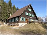 | Bresternica (spodnji Rušnik) - Koča na Žavcarjevem vrhu
The mountain hut is located just 10 metres below Žavcarjev vrh, on the slopes of Kozjak. From the hut, which is mostly surrounded by forest, we h...
1 h 30 min |
 | Jelovec - Koča na Žavcarjevem vrhu
The mountain hut is located just 10 metres below Žavcarjev vrh, on the slopes of Kozjak. From the hut, which is mostly surrounded by forest, we h...
2 h 15 min |
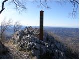 | Vitovlje - Sekulak
Sekulak is a viewpoint located on a side ridge of the Chavén massif. Sekulak is situated on a ridge that juts out from the line of the main ridge...
1 h 30 min |
 | Vitovlje - Sekulak (via Vitovlje Lake)
Sekulak is a viewpoint located on a side ridge of the Chavén massif. Sekulak is situated on a ridge that juts out from the line of the main ridge...
1 h 40 min |
 | Vitovlje (Križišče) - Kopitnik (via Hunting cottage LD Lijak)
Kopitnik, known as a take-off point for hang-gliders and paragliders, is located above the village of Vitovlje above the Vipava valley. There is ...
1 h 25 min |
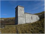 | Lozice - Sveti Hieronim
The Church of St. Jerome is located on the southern part of the Nanos plateau, just above the steep slopes of Rebrnice. The church, which was bui...
2 h 15 min |
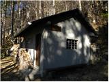 | Vrtovin - Bivak Črna peč
Bivak Črna peč is a closed bivouac owned by the Čaven hunting family. The bivouac is located under the steep slopes of Črna peča and is not overl...
1 h 45 min |
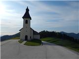 | Železniki - Prtovč (via Draoboslovica)
Prtovč is a small hill village located west of Železniki. On a grassy ridge, in the immediate vicinity of the village, stands the Church of Our L...
1 h 45 min |
 | Kokarje (ŠRC Laze) - Holy Mother of God on Čreta (via Tajna)
The Church of the Holy Mother of God at Čreta is located to the west of the lesser-known and forested Vrhe peak. From the church, or its immediat...
1 h 40 min |
 | Kokarje (ŠRC Laze) - Holy Mother of God on Čreta (via Dom na Farbanci)
The Church of the Holy Mother of God at Čreta is located to the west of the lesser-known and forested Vrhe peak. From the church, or its immediat...
2 h |
 | Potok (Mostni graben) - Holy Mother of God on Čreta (via Dom na Farbanci)
The Church of the Holy Mother of God at Čreta is located to the west of the lesser-known and forested Vrhe peak. From the church, or its immediat...
1 h 35 min |
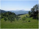 | Lavamünd - St. Lorenzen (Lorenzenberg)
The Church of St. Lawrence, or St. Lorenez in German, is located at the edge of the village of Lorenzenberg, just east of Labot/Lavamünd. From th...
2 h |
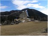 | Loke - Planinski dom Vrhe
Planinski dom Vrhe is located on the south-eastern slopes of Kisovec, from where we have a beautiful view of the nearby Javor. Near the house, wh...
1 h 50 min |
 | Gradišče na Kozjaku (Hajdišev mlin) - Sveti Duh na Ostrem Vrhu
Sveti Duh na Ostrem Vrhu is a small settlement located north of the River Drava and on the border with Austria. On a hill above the settlement st...
1 h 30 min |
 | Poljane nad Škofjo Loko - St. Primož and Felicijan on Gabrška gora
The Church of St Primož and Felicijan is located on Gabrška Gora, which is above the Poljanska Valley. From the church or its immediate surroundi...
1 h 20 min |
 | Muta (Spodnja Muta) - Sveti Primož above Muta
Sveti Primož above Muta is a scattered settlement rising north of Muta. The Church of St. Primož and Felicijan, located on the ridge between Prim...
1 h 20 min |
 | Muta (Spodnja Muta) - Zavetišče Onuk - Glavar
Zavetišče Onuk - Glavar is located below the Bricnik peak in the village of Sv. Primož nad Muto. The shelter has a KPP (Koroška planinska pot) st...
1 h 35 min |
 | Radlje ob Dravi - Zavetišče Onuk - Glavar
Zavetišče Onuk - Glavar is located below the Bricnik peak in the village of Sv. Primož nad Muto. The shelter has a KPP (Koroška planinska pot) st...
2 h 15 min |
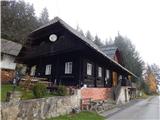 | Bistriški jarek (border crossing Muta) - Church of St. Simon and Judah Tadej (Pernice)
Pernice is a settlement located between Gortina, Kozji vrh and Bistriški trench. On Pernice there is the Church of St. Simon and St. Jude Thaddeu...
1 h 50 min |
 | Bistriški jarek (Glasbeni dom) - Church of St. Simon and Judah Tadej (Pernice)
Pernice is a settlement located between Gortina, Kozji vrh and Bistriški trench. On Pernice there is the Church of St. Simon and St. Jude Thaddeu...
1 h 45 min |
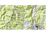 | Rein - Mühlbacher Hütte (Hunting path / Jägersteig)
The Mühlbacher Hütte hut is situated at 996 m above sea level above the Mühlbach Gorge near Rein and is a popular destination for cyclists and hi...
2 h |
 | Rein - Mühlbacher Hütte (via Hochstein)
The Mühlbacher Hütte hut is situated at 996 m above sea level above the Mühlbach Gorge near Rein and is a popular destination for cyclists and hi...
2 h 15 min |
 | Činžat - Sveti Križ (Kumen)
Chapel Sveti Križ is located on the outskirts of Kumen, near the Lampreht homestead. The chapel offers a beautiful view of the nearby homestead a...
1 h 25 min |
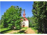 | Lovrenc na Pohorju - Sveti Ignacij (Rdeči Breg)
The Church of St Ignatius is located on the outskirts of Rdeči Breg, which rises north-west of Lovrenc na Pohorju and just below Hlebovo vrh. Fro...
2 h 5 min |
 | Janževski Vrh (Uran) - Sveti Ignacij (Rdeči Breg)
The Church of St Ignatius is located on the outskirts of Rdeči Breg, which rises north-west of Lovrenc na Pohorju and just below Hlebovo vrh. Fro...
1 h 25 min |
 | Janževski Vrh (Uran) - Sveti Ignacij (Rdeči Breg) (via Brabar)
The Church of St Ignatius is located on the outskirts of Rdeči Breg, which rises north-west of Lovrenc na Pohorju and just below Hlebovo vrh. Fro...
1 h 35 min |
 | Podvelka - Sveti Ignacij (Rdeči Breg)
The Church of St Ignatius is located on the outskirts of Rdeči Breg, which rises north-west of Lovrenc na Pohorju and just below Hlebovo vrh. Fro...
1 h 55 min |
 | Lovrenc na Pohorju - Hunting cottage Klančnik (via Kapus)
Hunting cottage Klančnik is located just below the summit of Klančnik, on the grassy slopes of the Red Brego....
2 h 5 min |
 | Janževski Vrh (Uran) - Hunting cottage Klančnik (via Sveti Ignacij)
Hunting cottage Klančnik is located just below the summit of Klančnik, on the grassy slopes of the Red Brego....
1 h 55 min |
 | HE Ožbalt - Hunting cottage Klančnik
Hunting cottage Klančnik is located just below the summit of Klančnik, on the grassy slopes of the Red Brego....
2 h 15 min |
 | Vitanje - Chapel Marijina roka (Stenica)
Chapel Marijina roka se nahaja nekaj minut pod vrhom Stenica, le ta pa na Mali gori, ki se strmo dviga nad krajem Vitanje....
1 h 40 min |
 | Zgornja Bistrica (Center Vintgar) - Marolt fir tree (Bistriški vintgar)
Marolt fir tree is now slowly decaying, but until 2010, when it collapsed in a fire, it was the thickest fir tree in Europe at 600 cm at chest he...
1 h 45 min |
 | Spodnje Radvanje - Sveti Bolfenk (Mariborsko Pohorje) (on SPP)
The Church of St. Bolfenko on Mariborsko Pohorje is located near the top station of the funicular and near the Bellevue Hotel....
2 h |
 | Spodnje Radvanje - Sveti Bolfenk (Mariborsko Pohorje) (southern path)
The Church of St. Bolfenko on Mariborsko Pohorje is located near the top station of the funicular and near the Bellevue Hotel....
2 h 15 min |
 | Stubenbergsee - Mariabrunn (via Kulmkögerl)
Mariabrunn is a small church located on the western slopes of Kulm Peak....
1 h 53 min |
 | Zgornja Bistrica (Center Vintgar) - Ponds Devin in Ošelj (via Bistriški vintgar)
...
2 h 15 min |
 | Zgornja Bistrica (Center Vintgar) - Pond west of Ošelj (via Bistriški vintgar)
...
2 h 5 min |
 | Ruše - Sveta Marija (Smolnik)
...
2 h 5 min |
 | Smolnik (Marotov most) - Sveta Marija (Smolnik) (through valley of Lobnica)
...
2 h 5 min |
 | Pivola (Reka) - Hotel Tisa (Poštarski dom) (via Petkovo sedlo)
...
1 h 45 min |
 | Dolina Sopote (Zagrad) - Sveta Trojica (Čimerno)
...
1 h 40 min |
 | Bistriški jarek (Glasbeni dom) - Arl's Pine
...
2 h |
 | Bistriški jarek (border crossing Muta) - Arl's Pine
...
2 h 5 min |