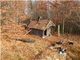
 | Molnarjev breg - Kamniški vrh (via planina Osredek)
Kamniški vrh is a 1259 m high mountain located north of Kamnik, between Stahovica and the Korošica Valley. From the top of the peak there is a sm...
1 h 30 min |
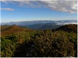 | Škrbina - Mali Golak
Mali Golak is the highest of the Golaks. It was named not because it was the smallest but because it had the smallest mountain pasture. On the ma...
2 h |
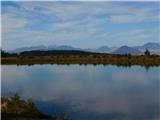 | Grmovškov dom pod Veliko Kopo - Mali Črni vrh
Mali Črni vrh is located above the Ribniško hut. At the top is an artificial lake used for artificial snowmaking on the ski slope. From the top t...
1 h 35 min |
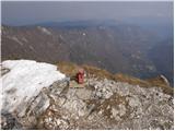 | Lokve - Poldanovec
Poldanovec is located in Govce on the northern edge of Trnovo plateau. Govci are quickly rising above Gorenje Trebuše valley. Poldanovec is not t...
1 h 30 min |
 | Turški klanec - Mrzovec
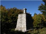
Mrzovec is the most expressing peak in heart of Trnovo plateau. His position offers us great view, but is also limited with high trees. Thats why...
1 h 30 min |
 | Koča na Šumiku - Žigartov vrh
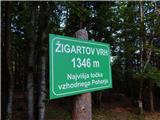
At 1346m, Žigartov vrh is the highest peak in the eastern part of Pohorje. An "observation" tower used to stand on the summit, but was erected on...
1 h 55 min |
 | Mariborska koča - Žigartov vrh
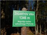
At 1346m, Žigartov vrh is the highest peak in the eastern part of Pohorje. An "observation" tower used to stand on the summit, but was erected on...
1 h 40 min |
 | Atelsko sedlo - Boskovec
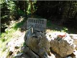
At 1587m, Boskovec is the highest peak of the Golta plateau. From the top of the lookout tower, you can see part of Kamnik Savinja Alps and the e...
1 h 30 min |
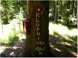 | Koča na Šumiku - Klopni vrh (eastern path)
Klopni vrh encloses the lower lying extensive plateau in the eastern Pohorje Mountains from the north-west. The area of the horizontal section at...
2 h |
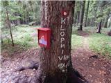 | Koča na Šumiku - Klopni vrh (northern path)
Klopni vrh encloses the lower lying extensive plateau in the eastern Pohorje Mountains from the north-west. The area of the horizontal section at...
2 h |
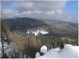 | Zgornji Goreljek - Javorov vrh (Pokljuka)
Javorov vrh is a 1482 m high mountain located between the vast forests of Pokljuka, more precisely between mountain pasture Konjska dolina and mo...
1 h 30 min |
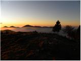 | Soriška peč - Žbajnek
Žbajnek is a 1538 m high peak located west of Ratitovec. The grassy peak, surrounded by a rare forest, offers a beautiful view of Julian Alps, Ka...
1 h 30 min |
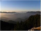 | Bohinjsko sedlo - Kačji rob (Ovharn)
Kačji rob is a 1520 m high peak located between mountain pasture Zgornji Jirn and the lesser known peak Žbanjek. The summit, which bears the Rati...
2 h |
 | Soriška peč - Kačji rob (Ovharn)
Kačji rob is a 1520 m high peak located between mountain pasture Zgornji Jirn and the lesser known peak Žbanjek. The summit, which bears the Rati...
2 h 30 min |
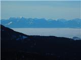 | Weinebene Straße - Weberkogel
Weberkogel is a less prominent peak located north to north-west of the Weinebene Alpine Pass. On the 1805 m high summit is a medium-sized cairn a...
1 h 30 min |
 | Koča na Klopnem vrhu - Pesek
Pesek is a 1423 m high peak on Pohorje, located above Koča na Pesku....
2 h 23 min |
 | Koča na Šumiku - Veliki vrh (on Pohorje)
Veliki vrh is a 1344-metre-high peak located above the RTC Jakec - Trije kralji ski resort. The highest point of the peak is located in the fores...
2 h |
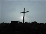 | Teichalm (Teichalmsee) - Rote Wand (zgornja pot)
Rote Wand is a 1505 m high mountain in the Graz mountain range in Styria, Austria. It is named "Rote Wand" (red wall) after the southeast-facing ...
2 h 15 min |
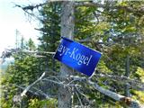 | Feistritzsattel - Grabmayr-Kogel
...
1 h 40 min |
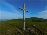 | Knödelhütte - Hirschegger Alm (južni vrh)
...
1 h 35 min |
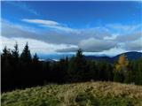 | Sommeralm - Osser
...
2 h |
 | Teichalm (Harrerhütte) - Osser
...
1 h 35 min |
 | Weinebene - Barofen
...
2 h |
 | Weinebene Straße - Barofen
...
1 h 40 min |
 | Gasthof Pfeifferstocker - Barofen
...
2 h |
 | Gasthof Pfeifferstocker - Renneiskogel
...
1 h 45 min |
 | Teichalm (Teichalmsee) - Gschaidberg (zgornja pot)
...
1 h 55 min |
 | Teichalm (Teichalmsee) - Gschaidberg (mimo križa Gerlerkreuz)
...
1 h 55 min |
 | Teichalm (Angerwirt) - Gschaidberg
...
1 h 50 min |
 | Schanzsattel - Stanglalpe
...
2 h 20 min |