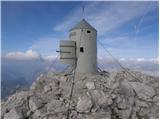
 | The Kot Valley - Triglav
Triglav is a 2864 m high mountain located in the heart of the Julian Alps. With its height, Triglav is the highest mountain in Slovenia and the h...
6 h 10 min |
 | The Krma Valley - Triglav (via Kredarica)
Triglav is a 2864 m high mountain located in the heart of the Julian Alps. With its height, Triglav is the highest mountain in Slovenia and the h...
6 h 10 min |
 | The Krma Valley - Triglav (via Planika and Mali Triglav)
Triglav is a 2864 m high mountain located in the heart of the Julian Alps. With its height, Triglav is the highest mountain in Slovenia and the h...
6 h |
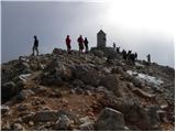 | The Krma Valley - Triglav (via Planika and Triglavska škrbina)
Triglav is a 2864 m high mountain located in the heart of the Julian Alps. With its height, Triglav is the highest mountain in Slovenia and the h...
5 h 45 min |
 | Stara Fužina - Triglav (via Planika and Mali Triglav)
Triglav is a 2864 m high mountain located in the heart of the Julian Alps. With its height, Triglav is the highest mountain in Slovenia and the h...
7 h 45 min |
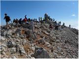 | Zadnjica - Triglav (via Plemenice)
Triglav is a 2864 m high mountain located in the heart of the Julian Alps. With its height, Triglav is the highest mountain in Slovenia and the h...
7 h 15 min |
 | Zadnjica - Triglav (via Dolič)
Triglav is a 2864 m high mountain located in the heart of the Julian Alps. With its height, Triglav is the highest mountain in Slovenia and the h...
7 h 15 min |
 | Koča pri Savici - Triglav (via Triglavska jezera)
Triglav is a 2864 m high mountain located in the heart of the Julian Alps. With its height, Triglav is the highest mountain in Slovenia and the h...
8 h 45 min |
 | Stara Fužina - Triglav (via Planika and Triglavska škrbina)
Triglav is a 2864 m high mountain located in the heart of the Julian Alps. With its height, Triglav is the highest mountain in Slovenia and the h...
7 h 30 min |
 | Zadnjica - Triglav (via Komar)
Triglav is a 2864 m high mountain located in the heart of the Julian Alps. With its height, Triglav is the highest mountain in Slovenia and the h...
7 h 15 min |
 | Srednja vas - Triglav (Za Ribnico and via Triglavska škrbina)
Triglav is a 2864 m high mountain located in the heart of the Julian Alps. With its height, Triglav is the highest mountain in Slovenia and the h...
7 h 45 min |
 | Ruski križ - Škrlatica (via Kriška stena)
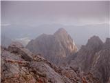
Škrlatica is the second highest mountain in Slovenia. There is a cross at the top, which makes it easy to identify the peak from neighbouring mou...
7 h 30 min |
 | Zadnjica - Škrlatica
Škrlatica is the second highest mountain in Slovenia. There is a cross at the top, which makes it easy to identify the peak from neighbouring mou...
8 h 45 min |
 | Pišnica - Škrlatica (via Kriška stena)
Škrlatica is the second highest mountain in Slovenia. There is a cross at the top, which makes it easy to identify the peak from neighbouring mou...
8 h 5 min |
 | The Kot Valley - Mali Triglav
Mali Triglav is an undistinguished peak in the main ridge of Triglav. Despite its great height, few people decide to set out on their own. Most o...
5 h 35 min |
 | Zadnjica - Razor
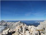
The summit is located above the Alpine valley of Mlinarica. The summit, which is not spacious, has a very nice view. All the peaks above the Kriš...
6 h |
 | Ruski križ - Razor (via Kriška stena)
The summit is located above the Alpine valley of Mlinarica. The summit, which is not spacious, has a very nice view. All the peaks above the Kriš...
7 h 10 min |
 | Ruski križ - Dolkova špica (via Kriška stena)
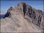
Dolkova špica is a 2591 m high mountain located between Stenar and Škrlatica. From the summit, where the registration box is located, you can enj...
5 h 45 min |
 | Pišnica - Dolkova špica (via Kriška stena)
Dolkova špica is a 2591 m high mountain located between Stenar and Škrlatica. From the summit, where the registration box is located, you can enj...
6 h 20 min |
 | Korito / Coritis - Visoki Kanin (Via ferrata Rosalba Grasselli)
Visoki Kanin is the highest peak of the Kanin Mountains. From the summit on which the cross stands, you have a beautiful view of the western Juli...
6 h 50 min |
 | V Koncu - Grintovec (via Kokrsko and Mlinarsko sedlo)
Grintovec is the highest peak in the Kamnik and Savinja Alps. It is located above the valley of Kamniška Bistrica, Suhi dol and above the valley ...
5 h 30 min |
 | Suhadolnik - Grintovec (via Kokrsko and Mlinarsko sedlo)
Grintovec is the highest peak in the Kamnik and Savinja Alps. It is located above the valley of Kamniška Bistrica, Suhi dol and above the valley ...
5 h 45 min |
 | Ravenska Kočna - Grintovec (past the cableway and on Frischaufova pot)
Grintovec is the highest peak in the Kamnik and Savinja Alps. It is located above the valley of Kamniška Bistrica, Suhi dol and above the valley ...
5 h 15 min |
 | Ravenska Kočna - Grintovec (past the cableway and on Kremžarjeva pot)
Grintovec is the highest peak in the Kamnik and Savinja Alps. It is located above the valley of Kamniška Bistrica, Suhi dol and above the valley ...
5 h 15 min |
 | Ravenska Kočna - Grintovec (umik Žrela and on Frischaufova pot)
Grintovec is the highest peak in the Kamnik and Savinja Alps. It is located above the valley of Kamniška Bistrica, Suhi dol and above the valley ...
5 h 20 min |
 | Ravenska Kočna - Grintovec (umik Žrela and on Kremžarjeva pot)
Grintovec is the highest peak in the Kamnik and Savinja Alps. It is located above the valley of Kamniška Bistrica, Suhi dol and above the valley ...
5 h 20 min |
 | Ravenska Kočna - Grintovec (via Štularjeva planina and on path Frischaufova pot)
Grintovec is the highest peak in the Kamnik and Savinja Alps. It is located above the valley of Kamniška Bistrica, Suhi dol and above the valley ...
5 h 30 min |
 | Ravenska Kočna - Grintovec (via Štularjeva planina and on path Kremžarjeva pot)
Grintovec is the highest peak in the Kamnik and Savinja Alps. It is located above the valley of Kamniška Bistrica, Suhi dol and above the valley ...
5 h 30 min |
 | Ravenska Kočna - Jezerska Kočna (Frischauf way)
Jezerska Kočna is located west of Grintovec. From the top there is a very nice view towards Grintovec. Karawanks and the Gorenjska plain are also...
6 h 30 min |
 | Suhadolnik - Jezerska Kočna (via Grdi graben and Dolci)
Jezerska Kočna is located west of Grintovec. From the top there is a very nice view towards Grintovec. Karawanks and the Gorenjska plain are also...
5 h 15 min |
 | Suhadolnik - Jezerska Kočna (via Kokrsko sedlo and Dolci)
Jezerska Kočna is located west of Grintovec. From the top there is a very nice view towards Grintovec. Karawanks and the Gorenjska plain are also...
6 h 15 min |
 | V Koncu - Jezerska Kočna (via Dolci)
Jezerska Kočna is located west of Grintovec. From the top there is a very nice view towards Grintovec. Karawanks and the Gorenjska plain are also...
6 h |
 | V Koncu - Jezerska Kočna (via Kokrska Kočna)
Jezerska Kočna is located west of Grintovec. From the top there is a very nice view towards Grintovec. Karawanks and the Gorenjska plain are also...
6 h |
 | Suhadolnik - Jezerska Kočna (via Grdi graben and Kokrska Kočna)
Jezerska Kočna is located west of Grintovec. From the top there is a very nice view towards Grintovec. Karawanks and the Gorenjska plain are also...
5 h 15 min |
 | Suhadolnik - Jezerska Kočna (via Kokrsko sedlo and Kokrska Kočna)
Jezerska Kočna is located west of Grintovec. From the top there is a very nice view towards Grintovec. Karawanks and the Gorenjska plain are also...
6 h 15 min |
 | Ravenska Kočna - Jezerska Kočna (umik Žrela and on Frischaufova pot)
Jezerska Kočna is located west of Grintovec. From the top there is a very nice view towards Grintovec. Karawanks and the Gorenjska plain are also...
6 h 35 min |
 | Ravenska Kočna - Jezerska Kočna (via Štularjeva planina and on path Frischaufova pot)
Jezerska Kočna is located west of Grintovec. From the top there is a very nice view towards Grintovec. Karawanks and the Gorenjska plain are also...
6 h 30 min |
 | Ravenska Kočna - Skuta (past the cableway and over Dolgi hrbet)
Skuta is a 2532 m high mountain located in the heart of the Kamink Savinja Alps. From the top, where there is a registration box and a stamp, we ...
5 h 45 min |
 | Ravenska Kočna - Skuta (umik Žrela and over Dolgi hrbet)
Skuta is a 2532 m high mountain located in the heart of the Kamink Savinja Alps. From the top, where there is a registration box and a stamp, we ...
5 h 50 min |
 | Ravenska Kočna - Skuta (via Štularjeva planina and Dolgi hrbet)
Skuta is a 2532 m high mountain located in the heart of the Kamink Savinja Alps. From the top, where there is a registration box and a stamp, we ...
5 h 45 min |
 | Ravenska Kočna - Kokrska Kočna (past the cableway and on Kremžarjeva pot)
Kokrska Kočna is a scenic and vast mountain between Jezersko and Suhadolnik. From the top, which has a registration box, there is a very nice vie...
5 h 30 min |
 | Suhadolnik - Kokrska Kočna (via Kokrsko sedlo)
Kokrska Kočna is a scenic and vast mountain between Jezersko and Suhadolnik. From the top, which has a registration box, there is a very nice vie...
5 h 45 min |
 | V Koncu - Kokrska Kočna
Kokrska Kočna is a scenic and vast mountain between Jezersko and Suhadolnik. From the top, which has a registration box, there is a very nice vie...
5 h 30 min |
 | Ravenska Kočna - Kokrska Kočna (umik Žrela and on Kremžarjeva pot)
Kokrska Kočna is a scenic and vast mountain between Jezersko and Suhadolnik. From the top, which has a registration box, there is a very nice vie...
5 h 35 min |
 | Ravenska Kočna - Kokrska Kočna (via Štularjeva planina and on path Kremžarjeva pot)
Kokrska Kočna is a scenic and vast mountain between Jezersko and Suhadolnik. From the top, which has a registration box, there is a very nice vie...
5 h 30 min |
 | Ruski križ - Stenar (via Križ)
Stenar is a 2501 m high peak rising steeply above the Vrata valley. From the spacious summit, where there is a registration box and a stamp, we h...
6 h 15 min |
 | Pišnica - Stenar (via Križ)
Stenar is a 2501 m high peak rising steeply above the Vrata valley. From the spacious summit, where there is a registration box and a stamp, we h...
6 h 50 min |
 | Pišnica - Špik (via Koča v Krnici)
Špik is a 2,472 m high mountain located in the heart of the Martuljek Mountains. From the top, which is clearly visible from the road leading thr...
5 h 30 min |
 | V Koncu - Brana (via Turska gora)
Brana is a mountain above Kamnik saddle. The view from the spacious summit, which has a registration box and a small cross, is very beautiful. Pl...
5 h 45 min |
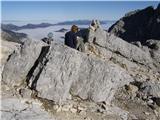 | Pišnica - Križ
Križ is a 2140 m high mountain located north-east of the Kriški Podi. From the top, where there is a registration box with a stamp, you have a be...
5 h 20 min |
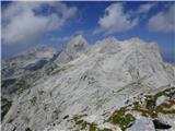 | Suhadolnik - Turska gora
The mountain is located above the Logarska Valley and the Kamniška Bistrica Valley. From the top there is a beautiful view towards the neighbouri...
6 h 15 min |
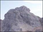 | Ruski križ - Planja (via Kriška stena)
The summit is located between two Alpine valleys. On the northern side is the Mlinarica valley and on the southern side is the Zadnjica valley. F...
6 h 55 min |
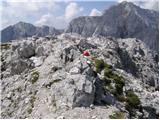 | Ravenska Kočna - Mrzla gora (Slovenian way)
This hard-to-reach mountain is located on the border with Austria in the Kamnik and Savinja Alps. From the top you can enjoy a beautiful view of ...
5 h 45 min |
 | Belska Kočna - Mrzla gora
This hard-to-reach mountain is located on the border with Austria in the Kamnik and Savinja Alps. From the top you can enjoy a beautiful view of ...
5 h 40 min |
 | Ravenska Kočna - Mrzla gora (via Žrelo)
This hard-to-reach mountain is located on the border with Austria in the Kamnik and Savinja Alps. From the top you can enjoy a beautiful view of ...
5 h 45 min |
 | Ravenska Kočna - Mrzla gora (hunting path)
This hard-to-reach mountain is located on the border with Austria in the Kamnik and Savinja Alps. From the top you can enjoy a beautiful view of ...
6 h |
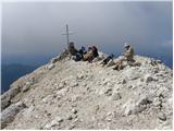 | Planina Zajzera - Jôf di Montasio/Montaž (Via Amalia)
Jôf di Montasio is one of the most majestic mountains in the Julian Alps and with its 2753m it is the second highest. The authentic Slovenian nam...
6 h 45 min |
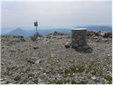 | Podkraj / Unterort - Petzen (Kordeschkopf) (Peca (Kordeževa glava)) (Walter Mory Klettersteig)
Kordeževa glava, better known as Peca is the highest summit in the mountain chain Peca. It is located on the border with Austria above Mežiška do...
5 h 20 min |
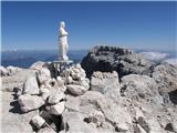 | Rio Bianco - Viš/Jof Fuart (Sentiero del Centenario)
Viš is a 2666m high peak in the western Julian Alps. From the top, where the statue of St Mary and the cross stand, you can enjoy a beautiful vie...
6 h |
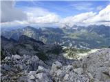 | Korito / Coritis - Vrh Krnice
Vrh Krnice is a 2441 m high peak located north-west of Visoki Kanin. From the summit, where the usually empty registration box stands, you can en...
5 h 50 min |
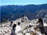 | Parking Alpspitzbahn - Alpspitze (Alpspitz Ferrata)
Alpspitze is a 2628 m high peak in the Wetterstein mountain group. The summit, on which the 1946 cross stands, offers a very beautiful view of th...
6 h 15 min |
 | Cellino di Sopra - Col Nudo
Col Nudo is a central mountain in the south-western part of the Carnioan Pre-Alps, on the border between Veneto and Friuli-Venezia Giulia. It off...
6 h 30 min |
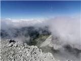 | Railway station Hochzirl - Kleiner Solstein (on Höttinger Schützensteig)
Kleiner Solstein is the highest peak of the famous Nordkette ridge barrier, which hides the central part of the Karwendel from the valley and cre...
6 h |