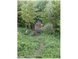
 | Cerknica (Senior citizens home) - Slivnica (Zatrepi - Slivnica)
Slivnica is a 1114 m high peak located north of Cerknica polje. The view from the summit, where the entry box is located, is rather limited due t...
1 h 30 min |
 | Spodnja Kokra - Javorov vrh (via Baba)
Javorov vrh (also Javorjev vrh according to some records) is a 1434 m high mountain located northeast of Preddvor. From the top, which has a regi...
2 h 30 min |
 | Klemenčevo - Kamniški vrh (by Korošaki waterfalls)
Kamniški vrh is a 1259 m high mountain located north of Kamnik, between Stahovica and the Korošica Valley. From the top of the peak there is a sm...
2 h 15 min |
 | Klemenčevo - Kamniški vrh (on southwest slope)
Kamniški vrh is a 1259 m high mountain located north of Kamnik, between Stahovica and the Korošica Valley. From the top of the peak there is a sm...
1 h 45 min |
 | Iverje - Kamniški vrh (via Hudi Konci)
Kamniški vrh is a 1259 m high mountain located north of Kamnik, between Stahovica and the Korošica Valley. From the top of the peak there is a sm...
2 h 15 min |
 | Češnjice v Tuhinju - Vivodnik
At 1508 m, Vivodnik is the highest peak of the Menina mountain pasture, a plateau rising south of Gornji Grad. From the top, where there is a sma...
2 h 25 min |
 | Razdrto - Vojkova koča na Nanosu (Janez way)
Vojkova koča is located on the southern edge of the Nanoše plateau, close to Pleše, a peak that is clearly visible from the motorway. From the hu...
2 h |
 | Source of Ljubija - Smrekovec (via Leskovškova pustota)
Smrekovec is a volcanic mountain on the eastern edge of the Smrekov Mountains. The extensive grassy summit, on which stands a pyramid with a regi...
2 h 20 min |
| Source of Ljubija - Smrekovec (by road)
Smrekovec is a volcanic mountain on the eastern edge of the Smrekov Mountains. The extensive grassy summit, on which stands a pyramid with a regi...
2 h 30 min |
 | Selski most - Babji zob
Babji zob is a lookout point above the village of Kupljenik near Bled. The precipitous peak, which has a registration box, has a beautiful view o...
2 h 30 min |
 | Poljšica pri Gorjah (Zatrata) - Galetovec (on footpath)
Galetovec is an undistinguished peak in the south-eastern part of the Pokljuka plateau. From the summit, which has a registration box, there is a...
2 h 35 min |
 | Bač - Kršičevec
Kršičevec is a lesser known mountain located east of the village Jurišče in the Pivka Basin. From the grassy summit, where there is a registratio...
2 h 15 min |
 | Podbreg - Logarska peč
Logarska peč is a peak or viewpoint a few metres below the summit, rising steeply above the Logarska dolina valley. Logarska peč offers a very ni...
2 h 20 min |
 | Orehek - Kojca (new path)
Kojca is a scenic peak rising south of Baška Grape. The hay pile on the top offers a beautiful view of the Lower Bohinj Mountains, the Škofjelošk...
1 h 40 min |
 | Bukovo - Kojca (north path)
Kojca is a scenic peak rising south of Baška Grape. The hay pile on the top offers a beautiful view of the Lower Bohinj Mountains, the Škofjelošk...
2 h 15 min |
| Bukovo - Kojca (south path)
Kojca is a scenic peak rising south of Baška Grape. The hay pile on the top offers a beautiful view of the Lower Bohinj Mountains, the Škofjelošk...
2 h 15 min |
 | Begunje (Krpin) - Smokuški vrh (on cart track and past sv. Peter)
Smokuški vrh is a scenic mountain located on a ridge between the Završnice valley and the Gorenjska plain. From the top of the hill, where there ...
1 h 50 min |
 | Rodine - Smokuški vrh (via Sankaška koča)
Smokuški vrh is a scenic mountain located on a ridge between the Završnice valley and the Gorenjska plain. From the top of the hill, where there ...
1 h 45 min |
| Begunje (Krpin) - Smokuški vrh (by road)
Smokuški vrh is a scenic mountain located on a ridge between the Završnice valley and the Gorenjska plain. From the top of the hill, where there ...
1 h 35 min |
 | Begunje (Krpin) - Smokuški vrh (through Blatnica Gorge)
Smokuški vrh is a scenic mountain located on a ridge between the Završnice valley and the Gorenjska plain. From the top of the hill, where there ...
1 h 40 min |
 | Zalog - Grebenc
Grebenc is a lesser-known peak, rising steeply above Malo and Velika Poljana. From this little visited peak, in good weather we can enjoy a beaut...
2 h 20 min |
 | Povlje - Grebenc
Grebenc is a lesser-known peak, rising steeply above Malo and Velika Poljana. From this little visited peak, in good weather we can enjoy a beaut...
2 h 5 min |
| Povlje - Grebenc (by cart track)
Grebenc is a lesser-known peak, rising steeply above Malo and Velika Poljana. From this little visited peak, in good weather we can enjoy a beaut...
2 h 5 min |
 | Spodnja Kokra - Baba
Baba is a 1119 m high peak located to the west of Čemšenik. From the summit, where the registration box is located, you can enjoy a beautiful vie...
1 h 35 min |
 | Potoče - Baba (via sv. Jakob and source below Potoška gora)
Baba is a 1119 m high peak located to the west of Čemšenik. From the summit, where the registration box is located, you can enjoy a beautiful vie...
2 h 10 min |
 | Razdrto - Grmada (Nanos)
Grmada is a 1209 m high peak located to the north-west of the better known Plesa. From the summit, where there is a registration box with a stamp...
2 h 5 min |
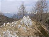
 | Livek - Kuk (Kolovrat)
At 1243 m, Kuk is the highest peak of the Kolovrat, the mountain range from Livko to Kambreški. The summit, which has several transmitters, offer...
1 h 30 min |
 | Vitanje - Stenica (via valley of the stream Jez)
Stenica is a 1091 m high peak located between Vitanje, Stranice and Frankolovi. There is no view from the top, which has a stamp with a registrat...
1 h 50 min |
 | Dom pod Reško planino - Javor
Javor is a 1132 m high peak located between Kisovec and Sveta mountain pasture. There is no view from the top, which is covered with forest, but ...
2 h 5 min |
 | Podvolovljek (Petkov graben) - Kunšperski vrh (Brezovec)
Kunšperski vrh, Brezovec is also a lesser known peak located west of Lepenatka. The partially vegetated peak offers a beautiful view towards Veli...
2 h |
 | Podljubelj (Lajb) - Čisovec
Čisovec is a scenic peak located between Dobrča and Begunjščica. From the top we have a beautiful view towards Košuta, Kamnik Savinja Alps, Begun...
2 h |
 | Bled (Velika Zaka) - Hotunjski vrh
Hotunjski vrh is a 1107-metre-high lookout peak located above the Zatrnik ski resort. From the top, where there is a registration box and a bench...
2 h 30 min |
| Bohinjska Bela (St. Marjeta) - Hotunjski vrh
Hotunjski vrh is a 1107-metre-high lookout peak located above the Zatrnik ski resort. From the top, where there is a registration box and a bench...
2 h 15 min |
 | Njivica - Bela peč (Podbliška gora)
Bela peč is located on the edge of Jelovica above the village of Podblica. From the top of the cliff we have a beautiful view of the village, the...
2 h 35 min |
| Nemilje - Bela peč (Podbliška gora) (via Sleme)
Bela peč is located on the edge of Jelovica above the village of Podblica. From the top of the cliff we have a beautiful view of the village, the...
2 h 25 min |
 | Mežica - Jesenik (Jesenikov vrh) (via saddle Vrh šteng)
Jesenik is a 1199 m high forested peak located between Mežica and Podpec....
2 h |
 | Mežica - Jesenik (Jesenikov vrh) (via homestead Jesenik)
Jesenik is a 1199 m high forested peak located between Mežica and Podpec....
2 h 5 min |
 | Mežica - Pikov vrh (via homestead Jesenik)
Pikov vrh is a 1149 m high peak located above Podpeca, more precisely above the Pik homestead, near the Koča na Pikovem. On the top there is a re...
2 h |
| Črna na Koroškem (Mušenik) - Pikov vrh (via Šumahovo sedlo)
Pikov vrh is a 1149 m high peak located above Podpeca, more precisely above the Pik homestead, near the Koča na Pikovem. On the top there is a re...
2 h 25 min |
| Črna na Koroškem (Mušenik) - Pikov vrh (via Koča na Pikovem)
Pikov vrh is a 1149 m high peak located above Podpeca, more precisely above the Pik homestead, near the Koča na Pikovem. On the top there is a re...
1 h 45 min |
 | Črna na Koroškem (Mušenik) - Veliki vrh (above Mežiška dolina) (via Šumahovo sedlo)
Veliki vrh is a 1165-metre-high peak located between Mežica and Črna na Koroškem. On the summit, there is a registration box with a registration ...
1 h 45 min |
| Črna na Koroškem (Mušenik) - Veliki vrh (above Mežiška dolina) (via Koča na Pikovem)
Veliki vrh is a 1165-metre-high peak located between Mežica and Črna na Koroškem. On the summit, there is a registration box with a registration ...
2 h 25 min |
 | Črna na Koroškem (Mušenik) - Šumahov vrh (via Šumahovo sedlo)
Šumahov vrh is a 1155-metre-high peak on which a wooden cross is erected. From the top, which descends steeply towards Žerjav, we have a beautifu...
1 h 45 min |
 | Spodnja Kokra - Škrbina (Slaparjeva gora) (via farm Zajc)
Škrbina is a 1142 m high peak located in the ridge of Slaparjeva gora, which is above the Kokra valley. From the top, we have a beautiful view to...
1 h 40 min |
 | Bela Peč / Villa Bassa - Črni vrh / Colrotondo
Črni vrh is a fairly scenic peak located west to south-west of the Belopek Lakes. From the summit, on which the hunting observation tower is situ...
2 h |
 | Rodine - Pleče (via Sankaška koča)
Pleče is a 1131-metre-high peak located north of St Peter above Begunje. The summit is covered by forest, but from near the top, we can enjoy som...
1 h 50 min |
| Begunje (Krpin) - Pleče (by ski slope and via Sankaška koča)
Pleče is a 1131-metre-high peak located north of St Peter above Begunje. The summit is covered by forest, but from near the top, we can enjoy som...
1 h 45 min |
| Begunje (PGD Begunje) - Pleče (Petrova pot)
Pleče is a 1131-metre-high peak located north of St Peter above Begunje. The summit is covered by forest, but from near the top, we can enjoy som...
1 h 45 min |
| Begunje (Krpin) - Pleče (by road)
Pleče is a 1131-metre-high peak located north of St Peter above Begunje. The summit is covered by forest, but from near the top, we can enjoy som...
1 h 40 min |
| Begunje (Krpin) - Pleče (through Blatnica Gorge)
Pleče is a 1131-metre-high peak located north of St Peter above Begunje. The summit is covered by forest, but from near the top, we can enjoy som...
1 h 45 min |
 | Podljubelj - Robič (via Zavetišče na Kalu)
Robič is a 1384 m high peak located between the valley of Tržiška Bistrica and the ridge of Košuta. The summit offers a beautiful view, especiall...
2 h 15 min |
| Dolina - Robič
Robič is a 1384 m high peak located between the valley of Tržiška Bistrica and the ridge of Košuta. The summit offers a beautiful view, especiall...
1 h 55 min |
 | Jelendol (mansion Puterhof) - Primožkovi hribi
Primožkovi hribi is a small ridge above Jelendol, located between the watercourses of the Tržiška Bistrica, Dolžanka and Zalega potok. The highes...
1 h 40 min |
 | Dovje - Bela peč (above Dovje)
Bele peči is a less known peak, located above the marked Dovje - Dovška Baba trail. The summit offers a beautiful view to the south and west, whi...
2 h |
| Dovje - Bela peč (above Dovje) (via Blažčeva skala)
Bele peči is a less known peak, located above the marked Dovje - Dovška Baba trail. The summit offers a beautiful view to the south and west, whi...
2 h 15 min |
 | Činžat - Lamprehtov vrh
Lamprehtov vrh is a 1230 m high peak on Pohorje, located north-east of Klopni vrh....
2 h 30 min |
 | Mixnitz (Parkirišče Bärenschützklamm) - Rannerwandkreuz
...
1 h 45 min |
 | Mixnitz (Parkirišče Bärenschützklamm) - Ranerwand
...
2 h 30 min |