 | Dom na Gospincu - Veliki Zvoh
Veliki Zvoh is the highest point of the Krvavec ski resort. The cable car does not quite reach the top, but it is only a few metres short of the ...
1 h 25 min |
| Kriška planina - Veliki Zvoh
Veliki Zvoh is the highest point of the Krvavec ski resort. The cable car does not quite reach the top, but it is only a few metres short of the ...
1 h 25 min |
 | Planina Jezerca - Veliki Zvoh (via Dom na Krvavcu)
Veliki Zvoh is the highest point of the Krvavec ski resort. The cable car does not quite reach the top, but it is only a few metres short of the ...
1 h 40 min |
 | Dom pod Storžičem - Tolsti vrh
Tolsti vrh, located to the west of Storžič, is also the highest peak of the Kriška Gora, a mountain range rising steeply above the central Gorenj...
2 h |
 | Snežniška Grda jama - Snežnik (via Mali Snežnik)
Snežnik or Veliki Snežnik is the highest peak in the near and far surroundings with a height of 1796 m. It offers a beautiful view over most of S...
1 h 25 min |
 | Gašperjev hrib - Snežnik
Snežnik or Veliki Snežnik is the highest peak in the near and far surroundings with a height of 1796 m. It offers a beautiful view over most of S...
1 h 30 min |
 | Gašperjev hrib - Snežnik
Snežnik or Veliki Snežnik is the highest peak in the near and far surroundings with a height of 1796 m. It offers a beautiful view over most of S...
1 h 30 min |
 | Sviščaki - Snežnik (variant through forest)
Snežnik or Veliki Snežnik is the highest peak in the near and far surroundings with a height of 1796 m. It offers a beautiful view over most of S...
2 h |
| Sežanje - Snežnik
Snežnik or Veliki Snežnik is the highest peak in the near and far surroundings with a height of 1796 m. It offers a beautiful view over most of S...
1 h 40 min |
 | Sviščaki - Snežnik (by road)
Snežnik or Veliki Snežnik is the highest peak in the near and far surroundings with a height of 1796 m. It offers a beautiful view over most of S...
1 h 55 min |
| Sviščaki - Snežnik (via Mali Snežnik)
Snežnik or Veliki Snežnik is the highest peak in the near and far surroundings with a height of 1796 m. It offers a beautiful view over most of S...
2 h 15 min |
 | Snežna jama - Velika Raduha
At 2062 m, Velika Raduha is the highest peak of Raduha, a mountain range rising steeply to the east of Robanov Kot. From the summit, which has a ...
1 h 45 min |
 | Črni Kal - Blegoš (by road, via hut)
Blegoš is a 1562 m high mountain located between Selška and Poljane Sora. From the grassy summit, on which there is a stamp and a registration bo...
1 h 30 min |
 | Črni kal - Blegoš (via Prva ravan)
Blegoš is a 1562 m high mountain located between Selška and Poljane Sora. From the grassy summit, on which there is a stamp and a registration bo...
1 h 20 min |
 | Bohinjsko sedlo - Možic (by Lajnar)
Možic is a 1602 m high peak located west of Soriška mountain pasture. It is at the highest point of the peak that there is an old military bunker...
1 h 30 min |
 | Hunting cottage (Davča) - Porezen
Porezen is a 1630 m high mountain located between Davča and Baška Grapa. From the top, where a large NOB monument stands, we have a beautiful vie...
1 h 45 min |
 | Podhočar - Porezen
Porezen is a 1630 m high mountain located between Davča and Baška Grapa. From the top, where a large NOB monument stands, we have a beautiful vie...
1 h 50 min |
 | end of road on Vogar - Pršivec (direct way)
Lookout Mountain is located above Lake Bohinj. The view is extensive on all sides. Triglav and the mountains around it can be seen, and on the ot...
1 h 30 min |
| end of road on Vogar - Pršivec (via planina Viševnik)
Lookout Mountain is located above Lake Bohinj. The view is extensive on all sides. Triglav and the mountains around it can be seen, and on the ot...
2 h 20 min |
 | Medvedova konta - Brda (west path)
Brda is a scenic peak located between Pokljuka and Krma. From the top, where a stamp is attached to a metal pole, we have a beautiful view toward...
2 h |
 | Planina Dol - Konj
Konj is a 1803 m high peak located between Velika planina and Presedlje. From the top, we have a beautiful view of the highest peaks of Kamnik Sa...
1 h 30 min |
 | Medvedova konta - Debeli vrh above Lipanca
Debeli vrh is a 1962 m high mountain located in a ridge of mountains rising steeply above the Krma valley. From the top, where a stamp is attache...
2 h 15 min |
 | Dom pod Storžičem - Bela peč
The mountain, which is known mainly by climbers, is located north of Storžič on the slopes of Konjščice. From the top there is a beautiful view o...
2 h |
| Dom pod Storžičem - Bela peč (via Javorniški preval)
The mountain, which is known mainly by climbers, is located north of Storžič on the slopes of Konjščice. From the top there is a beautiful view o...
2 h 5 min |
 | Ravne - Rosenkogel/Hruški vrh (direct way)
Rosenkogel is a 1776 m high mountain located between Frauenkogel and the slightly less known Klek. From the top, where there is a small chapel de...
2 h |
 | Bohinjsko sedlo - Šavnik (by Lajnar)
Šavnik is a grassy peak located between the Soriška planina and Kobla ski resorts. From the summit, which has a registration box with a stamp, yo...
2 h |
 | Bohinjsko sedlo - Šavnik
Šavnik is a grassy peak located between the Soriška planina and Kobla ski resorts. From the summit, which has a registration box with a stamp, yo...
1 h 30 min |
 | Ski hotel Vogel - Šija
The peak is located above the Vogel ski slope in the Lower Bohinj Mountains. From the top there is a beautiful view of the neighbouring peaks in ...
1 h 30 min |
 | Kramarica - Smrekovec (via Bukov stan)
Smrekovec is a volcanic mountain on the eastern edge of the Smrekov Mountains. The extensive grassy summit, on which stands a pyramid with a regi...
1 h 30 min |
| Kramarica - Smrekovec (by road)
Smrekovec is a volcanic mountain on the eastern edge of the Smrekov Mountains. The extensive grassy summit, on which stands a pyramid with a regi...
1 h 30 min |
 | Dom na Smrekovcu - Komen
At 1684m, Komen is the highest peak of the Smrekov Mountains, a mountain range bordering Styria and Carinthia. From the top, in good weather, we ...
2 h |
 | Planina Vodol - Veliki Travnik
Veliki Travnik, or Turnovka as the locals call it, is located on the western edge of the Smrekov Mountains. From the top of the hill, where a woo...
2 h |
 | Grda draga - Mali Snežnik
Mali Snežnik is a peak on the west ridge of Snežnika. Vrh, which is covered with dwarf pines, has a fine view of the neighbouring Veliki Snežnik ...
1 h 30 min |
| Sviščaki - Mali Snežnik
Mali Snežnik is a peak on the west ridge of Snežnika. Vrh, which is covered with dwarf pines, has a fine view of the neighbouring Veliki Snežnik ...
1 h 50 min |
 | Eisenkappler Hutte - Hochobir (Ojstrc)
Hochobir (Hochobir) is the highest peak of a small mountain range called Obir. It is located west of Železna Kapla (Eisenkappel) on the Austrian ...
1 h 35 min |
 | Planina Zapleč - Krasji vrh (via Koluji)
Krasji vrh is located between Bovec and Kobarid on the Polovnik mountain ridge. At 1773m, Krasji vrh is also the highest peak of the ridge, offer...
2 h |
| Planina Zapleč - Krasji vrh (via snežna jama)
Krasji vrh is located between Bovec and Kobarid on the Polovnik mountain ridge. At 1773m, Krasji vrh is also the highest peak of the ridge, offer...
2 h |
 | Walischeben - Weißenstein (Packalpe)
Weissenstein is a grassy mountain interspersed with wire fences. From its inconspicuous summit there is a fine view of the neighbouring Ameringko...
1 h 45 min |
 | Walischeben - Ameringkogel (Packalpe)
Ameringkogel is a grassy peak on which a cross is placed and on which a registration box is placed. At 2187m, it is also the highest peak in the ...
1 h 55 min |
 | Walischeben - Hofalmkogel (Packalpe) (via Weissenstein)
Hofalmkogel is a less prominent peak in the ridge from Großenberg to Speikkogel. The summit is broad and mostly covered with grass. From the top ...
2 h 5 min |
 | Walischeben - Hofalmkogel (Packalpe) (past the cross)
Hofalmkogel is a less prominent peak in the ridge from Großenberg to Speikkogel. The summit is broad and mostly covered with grass. From the top ...
2 h 5 min |
| Salzstiegelhaus - Hofalmkogel (Packalpe)
Hofalmkogel is a less prominent peak in the ridge from Großenberg to Speikkogel. The summit is broad and mostly covered with grass. From the top ...
1 h 50 min |
 | Walischeben - Speikkogel (Packalpe)
Speikkogel is a vast and grassy peak in the Packalps. From the top you can enjoy a beautiful view of the Slovenian mountains and the mountains of...
2 h |
 | Panoramarestaurant Oben - Petzen (Kordeschkopf) (Peca (Kordeževa glava))
Kordeževa glava, better known as Peca is the highest summit in the mountain chain Peca. It is located on the border with Austria above Mežiška do...
2 h 5 min |
 | Panoramarestaurant Oben - Petzen (Kordeschkopf) (Peca (Kordeževa glava)) (mimo stare koče)
Kordeževa glava, better known as Peca is the highest summit in the mountain chain Peca. It is located on the border with Austria above Mežiška do...
2 h 5 min |
 | Zadnji travnik - Govca (Olševa)
Govca is the highest peak of the Olševa, a mountain range rising above Koprivna, Solčava and Remschenik (Remschenik / Remschenig is a valley on t...
1 h 45 min |
 | Jezerski vrh - Kärntner Storschitz / Pristovški Storžič
Kärntner Storschitz is an extremely scenic peak above Jezersko. It offers a beautiful view of the northern flanks of the Grintovci Mountains, thr...
1 h 50 min |
 | Dolinza Alm/Planina Dolnica - Starhand
Starhand is a scenic peak on the eastern part of Carnic Alps near the better known Ojstrnik. From the top you can enjoy a beautiful view of the J...
1 h 40 min |
 | Rifugio Pelizzo - Monte Mataiur/Matajur (via Ledina)
Monte Mataiur is a scenic mountain located on the border between Slovenia and Itali. From the top, you have a beautiful view of the Kobarid or Br...
2 h |
 | Strugarjach / Strugarje - Sinacher Gupf / Psinski vrh
Sinacher Gupf (on maps we mostly see the name Psinski vrh) / Sinacher Gupf is a peak located north of the main chain Karawanks, more precisely no...
1 h 30 min |
 | Rosstratte - Dobratsch / Dobrač (by road)
Dobratsch is a massive mountain range located west of Belgrade. Its highest peak is the 2166m-high Kuhriegel, which has taken the name Dobratsch ...
1 h 20 min |
 | Rosstratte - Dobratsch / Dobrač (by road)
Dobratsch is a massive mountain range located west of Belgrade. Its highest peak is the 2166m-high Kuhriegel, which has taken the name Dobratsch ...
2 h |
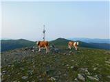
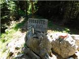 | Atelsko sedlo - Boskovec
At 1587m, Boskovec is the highest peak of the Golta plateau. From the top of the lookout tower, you can see part of Kamnik Savinja Alps and the e...
1 h 30 min |
 | Turracher Höhe - Rinsennock (northern way)
Rinsennock is a 2334m high peak located in the heart of the Krkonoše Alps. From the summit on which the cross stands, there is a beautiful view f...
1 h 45 min |
| Turracher Höhe - Rinsennock (southern way)
Rinsennock is a 2334m high peak located in the heart of the Krkonoše Alps. From the summit on which the cross stands, there is a beautiful view f...
1 h 45 min |
 | Heidi Alm - Klomnock
Klomnock is the house mountain of the Nockalmstraße Alpine road, which leads to the Schiestelscharte Pass (2024m). From the summit on which the c...
2 h 15 min |
 | Turracher Höhe - Schoberriegel
Schoberriegel is a 2208m high peak located between the Turracher Höhe Alpine Pass and the slightly higher Gruft. From the summit on which the cro...
1 h 20 min |
 | Turracher Höhe - Gruft
Gruft is a grass-covered peak located southeast of the Turracher Höhe Pass in the heart of the Krkonoše Alps. The 2232m-high peak offers a beauti...
1 h 45 min |
 | Sporthotel Maltatal - Arlhöhe
Arlhöhe is an inconspicuous peak located north of the Kölnbreinspeicher (above the Malta Valley). From the top of the peak, where the viewing pla...
1 h 45 min |
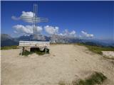
 | Korensko sedlo - Kamnati vrh/Steinberg (by road)
Kamnati vrh is a 1621 m high mountain located north of Kranjska Gora. The grassy summit, on which the bench is located, is not visible due to the...
2 h |
 | Planina Loka - Lanež (eastern way)
Lanež is a less distinct peak located in the eastern part of Raduha. The spacious peak offers a beautiful view of the nearby Mala Raduha, Olševa,...
1 h 25 min |
| Planina Loka - Lanež (via Durce)
Lanež is a less distinct peak located in the eastern part of Raduha. The spacious peak offers a beautiful view of the nearby Mala Raduha, Olševa,...
1 h 25 min |
 | Panoramarestaurant Oben - Feistritzer Spitze
Feistritzer Spitze is a 2113 m high peak located on the Austrian side of Pec. From the top on which the cross stands, you have a beautiful view o...
2 h 5 min |
 | Panoramarestaurant Oben - Feistritzer Spitze (mimo stare koče)
Feistritzer Spitze is a 2113 m high peak located on the Austrian side of Pec. From the top on which the cross stands, you have a beautiful view o...
2 h |
 | Panoramarestaurant Oben - Končnikov vrh
Končnikov vrh is a 2109 m high mountain located in the central part of Pec. The grassy peak offers a beautiful view along the Pec ridge and the m...
1 h 20 min |
 | Mangartska planina - Šober / Monte Sciober Grande (via Stože)
Šober is a 1845 m high peak located between Remšendol and the Jezersko Valley. From the top you can enjoy a beautiful view of the nearby Rabeljsk...
2 h 20 min |
 | Ledine - Gladki vrh (Ratitovec) (via planina Klom)
Gladki vrh is the most visited peak in the Ratitovec mountain range with an altitude of 1667 m. The uncultivated summit, on which the viewing pla...
1 h 55 min |
 | Torka - Gladki vrh (Ratitovec)
Gladki vrh is the most visited peak in the Ratitovec mountain range with an altitude of 1667 m. The uncultivated summit, on which the viewing pla...
1 h 20 min |
 | Torka - Altemaver (Ratitovec)
Altemaver is the highest peak of Ratitovec at 1678 m. The grassy peak offers a beautiful view of Julian Alps, Jelovica, Karawanks, Kamnik Savinja...
1 h 35 min |
 | Koprivna (Kumer) - Topitza
Topitza, or Topitza in German, is a 1649 m high peak located northeast of Železna Kapla. From the summit, on which the cross stands, we have a be...
2 h 10 min |
 | Rifugio Selvapiana I.Lunelli - Belvedere (Creston Popera)
Belvedere is a 2125 m high peak located on the slopes of the Creston Popera ridge, a famous World War I battlefield. A stone semicircle is erecte...
1 h 40 min |
 | Heidi Alm - Schwarzkofel (ridge path)
Schwarzkofel is a 2168 m high peak located south of mountain pasture Heidialm. From the summit, on which stands a small cross, there is a fine vi...
2 h |
| Heidi Alm - Schwarzkofel (via Falkertscharte)
Schwarzkofel is a 2168 m high peak located south of mountain pasture Heidialm. From the summit, on which stands a small cross, there is a fine vi...
2 h 5 min |
 | Heidi Alm - Rodresnock (ridge path)
Rodresnock is a 2310 m high mountain rising south-west of Lake Falkertsee. From the top, where a large cairn and a cross in the middle of it stan...
1 h 30 min |
 | Heidi Alm - Rodresnock (via Falkertscharte)
Rodresnock is a 2310 m high mountain rising south-west of Lake Falkertsee. From the top, where a large cairn and a cross in the middle of it stan...
1 h 30 min |
 | Heidi Alm - Falkert (via Falkertscharte)
Falkert is a 2308 m high peak located to the west of the village and lake Falkertsee. From the top, which has a few benches, a registration box w...
1 h 30 min |
 | Heidi Alm - Falkert (via Hundsfeldscharte)
Falkert is a 2308 m high peak located to the west of the village and lake Falkertsee. From the top, which has a few benches, a registration box w...
1 h 30 min |
 | Weinebene - Hühnerstütze (Golica/Koralpe)
Hühnerstütze is a 1989 m high peak located in the Golice / Koralpe mountain range. From the unmarked, mostly grassy summit, we have a beautiful v...
2 h |
 | parking below Weinebene - Hühnerstütze (Golica/Koralpe) (panoramic path)
Hühnerstütze is a 1989 m high peak located in the Golice / Koralpe mountain range. From the unmarked, mostly grassy summit, we have a beautiful v...
2 h |
 | Gasthof Pfeifferstocker - Handalm
Handalm is a 1,853-metre-high peak located north to north-east of the Weinebene Alpine Pass. The grassy summit, with a small granite boulder in t...
2 h 15 min |
 | Weinebene Straße - Weberkogel
Weberkogel is a less prominent peak located north to north-west of the Weinebene Alpine Pass. On the 1805 m high summit is a medium-sized cairn a...
1 h 30 min |
| Gasthof Pfeifferstocker - Weberkogel
Weberkogel is a less prominent peak located north to north-west of the Weinebene Alpine Pass. On the 1805 m high summit is a medium-sized cairn a...
1 h 50 min |
 | Iličev rovt / Illitsch Rauth - Kamnica (Komnica) / Ferlacher Spitze
Kamnica is a lookout mountain located on the Austrian side of Karawanks, more precisely north of Kepe. From the top, where there is a cross, a re...
1 h 35 min |
 | Zadnji travnik - Obel kamen (Olševa)
Obel kamen is a 1911 m high peak located in the Olševa Ridge. On the summit there is a boundary stone marked RS XXII 1, the cross and the registr...
2 h 15 min |
 | Parking Muritzen - Source of Mur / Murusprung (via Sticklerhütte)
Source of Mur is situated at an altitude of 1898 metres above sea level in the Muhrtal (Murwinkel) valley at the eastern foot of the Mureck mount...
2 h 15 min |
 | Eagles Nest - Mount Kosciuszko (Mt Kosciuszko Track)
Mount Kosciuszko is the highest mountain of the mainland Australia, it is the easiest one of the elite Seven Summits, and it is also among the Ul...
2 h |
 | Klippitztörl - Forstalpe (Saualpe) (via Geierkogel)
Forstalpe is an unstratified peak in the Svinja mountain pasture / Saualpe massif. The stamp for Forstalpe is located in an interesting natural w...
2 h 10 min |
| Klippitztörl - Forstalpe (Saualpe)
Forstalpe is an unstratified peak in the Svinja mountain pasture / Saualpe massif. The stamp for Forstalpe is located in an interesting natural w...
1 h 40 min |
 | Klippitztörl - Kienberg (Saualpe)
Kienberg is a 2050 m high peak in the Svinja mountain pasture / Saualpe massif. The grassy summit offers a beautiful view over most of the Svinsk...
2 h 20 min |
 | Passo Campolongo - Stores
Stores is a 2,185-metre peak in the south-eastern part of the Pralongia plateau. The grassy summit on which the cross stands offers a very fine v...
2 h |
 | Wiesser Alm - Mirnock (Path 184)
Mirnock is a 2110 m high isolated and very scenic mountain massif in Carinthia. It is part of the Nockberge Group, which is part of Gurktal Alps ...
1 h 30 min |
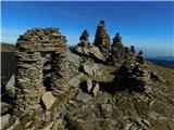 | parking below Weinebene - Steinmandl (Golica / Koralpe) (via Grünangerhütte)
Steinmandl is a scenic peak in the Golice / Koralpa mountain range, on which a large number of stone columns have been erected....
1 h 40 min |
 | Pfaffensattel - Grazer Stuhleck
...
2 h 15 min |
 | Knödelhütte - Hirschegger Alm (južni vrh)
...
1 h 35 min |
| Unterauerlinger Hütte - Hirschegger Alm (južni vrh)
...
1 h 25 min |
 | Unterauerlinger Hütte - Hirschegger Alm (severni vrh)
...
2 h 15 min |
 | Straßegg - Hochschlag
...
1 h 45 min |
 | Hebalm (Gasthaus Zur Rehbockhütte) - Barofen
...
2 h |
 | Gasthof Pfeifferstocker - Barofen
...
2 h |
 | Gasthof Pfeifferstocker - Renneiskogel
...
1 h 45 min |
 | Nassfeld - Javornik / Auernig
...
1 h 30 min |
 | Kohlebnerstand - Windberg (severna pot)
...
1 h 50 min |
| Kohlebnerstand - Windberg (južna pot)
...
1 h 50 min |
 | Kohlebnerstand - Hoher Klapf
...
1 h 40 min |