 | Borovec pri Kočevski Reki - Krempa
Krempa is a 944 m high mountain located in the central part of the Borovška Mountains, a mountain range rising steeply above the Upper Kolpa Vall...
50 min |
 | Selšček - Velika Špička
Velika Špička or Špičasto Stražišče is a peak located north of Slivnica. From the top, which has a registration box with a stamp, there is a beau...
45 min |
 | Begunje - Velika Špička (via Cemarovnik)
Velika Špička or Špičasto Stražišče is a peak located north of Slivnica. From the top, which has a registration box with a stamp, there is a beau...
1 h |
 | Begunje - Velika Špička
Velika Špička or Špičasto Stražišče is a peak located north of Slivnica. From the top, which has a registration box with a stamp, there is a beau...
1 h |
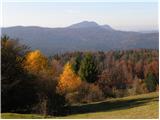 | Komarna vas - Gače
Gače is a popular excursion point for nature lovers and the only ski centre in Dolenjska (SC Bela), which offers pleasant skiing in winter and pl...
1 h |
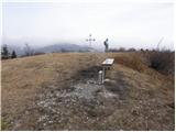 | Col - Kovk
Kovk is a scenic peak located to the west of Cola, on a jagged ridge rising steeply above the Vipava valley. From the top with a cross, we have a...
1 h |
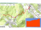 | Suhi Dol - Goli vrh (Uradna markirana pot)
Goli vrh, also known as Golni vrh on maps, is a nondescript forested peak located above the scattered settlement of Goli Vrh. There is no view fr...
1 h |
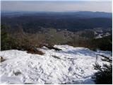 | Seljan - Stene svete Ane (gentle path)
Stene svete Ane is a vegetated peak located near the mountain hut at Sveti Anna on Mali gora. A small observation tower stands on the summit, whi...
1 h 5 min |
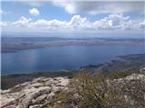 | Budaci - Velinac
...
1 h |
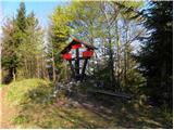 | Hunting sports association Vinska Gora - Ramšakov vrh
Ramšakov vrh is the highest point of the circular route around Vinská Gora. On the 970 m high summit, besides the bench, there is a registration ...
1 h |
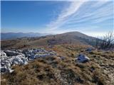 | Brest - Muzari (čez Žbevnico)
...
1 h |
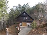 | Vrbiški dol - Koča na Kozleku
The hut is located south-west of Ilirska Bistrica, just a few metres below the top of Kozlek. From the top, the view is only to the south and wes...
1 h |
 | Lipa - Smolnik
Smolnik is a 1002 m high mountain located between Menina mountain pasture and Dobrovlje. The summit, which has a bench, a registration box and a ...
55 min |
 | Kamna Gora - Stolpnik
At 1012 m, Stolpnik is the highest peak of the Konjiška Gora, a mountain range stretching south-west from Slovenske Konjice. A 25 m high lookout ...
1 h |
 | Brest - Žbevnica (strma pot)
Žbevnica is a 1014 m high peak located above the village of Brest, on the Slovenian-Croatian border. The summit offers a beautiful view of Sloven...
45 min |
 | Brest - Žbevnica (položna pot)
Žbevnica is a 1014 m high peak located above the village of Brest, on the Slovenian-Croatian border. The summit offers a beautiful view of Sloven...
1 h |
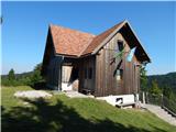 | Mali Log - Koča na Kamnem griču
The cottage is located on Kamný hill, a scenic peak rising south-west of Sodražica. The grassy summit, surrounded by forest, offers a beautiful v...
50 min |
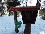 | Lipovnik - Šteharski vrh (Šteharnikov vrh)
Šteharski or Šteharnikov vrh, also Črneška gora, is a 1018-metre-high mountain located in the south-eastern part of Strojna, a mountain range bet...
45 min |
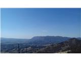 | saddle above Lohača - Špilnik (upper path - via Lipovec)
Špilnik is a less visited but very scenic peak on the south side of Hrušice, specifically above the village of Strmca. It has a central position ...
40 min |
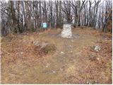 | Studeno - Gora (Sveti Lovrenc)
Gora, or Sveti Lovrenc, is a peak above Studeni. It is a village north of Postojna, which is also a good starting point for climbing to the top o...
1 h 5 min |
 | Selo - Tošč
Tošč, which became the highest peak of Polhograjsko hribovje decades ago when Pasja ravan was lowered by 9 m by the Yugoslav army, is located nor...
1 h |
 | Tourist farm Gonte - Tošč
Tošč, which became the highest peak of Polhograjsko hribovje decades ago when Pasja ravan was lowered by 9 m by the Yugoslav army, is located nor...
45 min |
 | Breznica - Lubnik
Lubnik is a 1025 m high mountain rising steeply to the west of Škofja Loka. From the summit, on which the mountain lodge stands, you can enjoy a ...
40 min |
 | Omar - Kolevrat
...
1 h |
 | Potoki - Ajdna
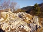
Ajdna is a peak with a beautiful view of Hochstuhl, Jelovica, Pokljuka and the Julian Alps. Part of the Gornjesavska valley between Žirovnica and...
1 h |
 | Petrovo Brdo - Kup
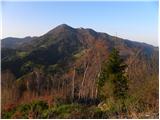
Kup is a 1046 m high peak located between Petrovy Brdo and Podbrdo. From the top, where there is a cross and a few transmitters, we have a beauti...
45 min |
 | Planina - Mirna gora
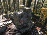
Mirna gora is a 1047 m high, forested peak located on the south-eastern edge of the Kočevje Horn. The summit, which has a registration box and a ...
45 min |
 | Malenski Vrh - Malenski vrh
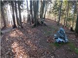
Malenski vrh is a 1051 m high mountain located west of Javorje. A small bench and cairn are located at the top, and the view of the surrounding h...
1 h 5 min |
 | Source of Ljubija - Sveti Križ above Bele Vode
Sveti Križ is a scenic mountain located above Beli Voda. From the top, which is home to a number of church buildings and a conversion tower, we h...
1 h 5 min |
 | Bele Vode (Sveti Andrej) - Sveti Križ above Bele Vode (upper path)
Sveti Križ is a scenic mountain located above Beli Voda. From the top, which is home to a number of church buildings and a conversion tower, we h...
1 h |
 | Zagrad - Ostrič
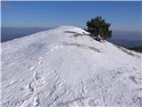
Ostrič (also marked as Žabnik on some maps) is a 1056m high peak located on the Slovenian side of Čičárija. From the uncultivated summit, on whic...
1 h 5 min |
 | Podmeja - Homič
...
1 h |
 | Štufna - Veliki Rog
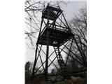
Veliki Rog is located in the middle of the endless forests of the Kočevki Rog karst plateau and is the highest peak with its 1099m altitude. The ...
50 min |
 | Sevski gozd - Sveta Trojica
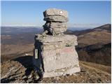
Sveta Trojica is a scenic peak located south-west of Javorniki. From the top, where the ruins of the former church are well preserved, you can en...
45 min |
 | Kampelc - Čelkov vrh
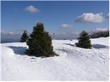
Čelkov vrh is a 1106m high peak located to the south of Črni vrh. From the summit, which has a registration box and a stamp, there is a beautiful...
50 min |
 | Dražgoše (Na Pečeh) - Dražgoška gora
Dražgoška gora is located on the southern slopes of Jelovica and covers quite a large area to the north-west of Dražgoš. The name Dražgoška gora ...
50 min |
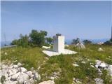 | Planinska koča Promina - Čavnovka (Promina) (po peš poti)
...
1 h |
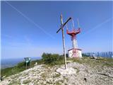 | Planinska koča Promina - Čavnovka (Promina) (po cesti)
...
1 h |
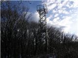 | Podkraj - Križna gora (Hrušica) (steep way)
Križna gora is a 1162 m high peak located north of the village of Podkraj. From the top of the lookout tower, you can enjoy a beautiful view over...
1 h |
 | Dom na Paškem Kozjaku - Ostrica
Ostrica is an undistinguished peak of Paški Kozjak, a 10 km long and rather narrow steep limestone mountain range between the Paka and Hudinja go...
1 h |
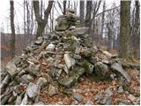 | Prvine - Črni vrh (Čemšeniška planina)
Črni vrh is the highest peak of Čemšeniška mountain pasture and with a height of 1204 m it is the second highest peak in the Posavje - Zasavje hi...
1 h |
 | Preval - Stari vrh
Stari vrh is a 1217 m high mountain located above the ski resort of the same name. There is no view from the summit itself due to the forest, but...
50 min |
 | Kalce - Mali Javornik (Javorniki)
Mali Javornik is a 1219 m high mountain located in the crest of the forested Javorniki Ridge. There is no view from the top due to the forest, bu...
1 h |
 | Lontovž - Kum (by road)
At 1220 metres, Kum is the highest peak of Posavsko hribovje. Because it rises above Zasavje, some people call it the Zasavje Triglav. On the sum...
50 min |
 | Lontovž - Kum (footpath)
At 1220 metres, Kum is the highest peak of Posavsko hribovje. Because it rises above Zasavje, some people call it the Zasavje Triglav. On the sum...
40 min |
 | Krnica - Veliki Rob
Veliki Rob is a scenic peak located between Kuclje (1237m) and Čavno (1185m). From the summit on which the cross is located, there is a beautiful...
40 min |
 | Nechnitz - Gschaidberg
...
45 min |
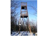 | Lome - Javornik above Črni vrh
Javornik is a forested peak located southeast of Črnji Vrho. In 1972, a lookout tower was erected on the summit, which reaches above the treetops...
1 h |
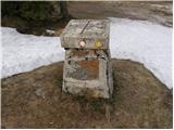 | Tuškov Grič - Črni vrh above Novaki
Črni vrh, the highest point of the popular Cerkno ski centre, is located north-east of Novaky. From the summit, near which an artificial lake has...
45 min |