 | Jezero - Krim (via Ledenica)
Krim is a 1107 m high mountain rising south of the Ljubljana Marshes. From the top of the mountain, where the mountain lodge and a number of tran...
2 h 30 min |
 | Strahomer - Krim (via Strmec)
Krim is a 1107 m high mountain rising south of the Ljubljana Marshes. From the top of the mountain, where the mountain lodge and a number of tran...
2 h 10 min |
| Strahomer - Krim (via Kramarca)
Krim is a 1107 m high mountain rising south of the Ljubljana Marshes. From the top of the mountain, where the mountain lodge and a number of tran...
2 h 10 min |
 | Vrbljene - Krim
Krim is a 1107 m high mountain rising south of the Ljubljana Marshes. From the top of the mountain, where the mountain lodge and a number of tran...
2 h 15 min |
| Tomišelj - Krim
Krim is a 1107 m high mountain rising south of the Ljubljana Marshes. From the top of the mountain, where the mountain lodge and a number of tran...
2 h 15 min |
| Jezero - Krim (via homestead Špelin)
Krim is a 1107 m high mountain rising south of the Ljubljana Marshes. From the top of the mountain, where the mountain lodge and a number of tran...
2 h 20 min |
 | Trbovlje - Mrzlica
Mrzlica has become an extremely popular excursion point in the last few years, especially for visitors from the Savinjska Valley and Zasavje. At ...
2 h 30 min |
 | Jevnica - Janče
Janče is a 792-metre-high peak located between the Sava River and the valley of the Besnica Stream. From the top, where the mountain lodge stands...
1 h 45 min |
 | Laze pri Dolskem - Janče
Janče is a 792-metre-high peak located between the Sava River and the valley of the Besnica Stream. From the top, where the mountain lodge stands...
2 h 15 min |
 | Senožeti - Cicelj
Cicelj is a forested peak located between Moravče and the village of Senožeti. There is no view from the top, which has a bench and a registratio...
1 h 30 min |
 | Kamnica - Cicelj (via farm Buven)
Cicelj is a forested peak located between Moravče and the village of Senožeti. There is no view from the top, which has a bench and a registratio...
1 h 45 min |
 | Kamnica - Cicelj
Cicelj is a forested peak located between Moravče and the village of Senožeti. There is no view from the top, which has a bench and a registratio...
1 h 40 min |
 | Senožeti - Cicelj (hunting path)
Cicelj is a forested peak located between Moravče and the village of Senožeti. There is no view from the top, which has a bench and a registratio...
1 h 30 min |
 | Stomaž - Mala gora
Mala gora is a plateau on the slope of the Chavn. A hut is located at an altitude of 1034 metres. Mala gora is known for its flowers, which are u...
2 h |
 | Kamnje - Mala gora
Mala gora is a plateau on the slope of the Chavn. A hut is located at an altitude of 1034 metres. Mala gora is known for its flowers, which are u...
2 h |
 | Source of Hubelj - Sinji vrh (via Otliško okno)
Sinji vrh is a scenic mountain located between Col, Ajdovščina and Predmeja. From the top, you can enjoy a beautiful view over most of western Sl...
2 h 15 min |
 | Source of Hubelj - Navrše
Navrše is a little-known peak located southeast of the Otliška Window. From the top there is a beautiful view of the Vipava valley and the peaks ...
1 h 35 min |
 | Spodnja Idrija - Jelenk (easy way)
Jelenk is a mountain between the valley of the Idrijca River, above which it rises steeply, and the valley of the Kanomljica River. The summit, w...
2 h |
 | Stoperce - Donačka gora
Donačka gora is a peak located north of Rogatec. The peak, which geographically belongs to Karawanks, offers a beautiful view of the surrounding ...
2 h 5 min |
 | Zidani Most - Veliko Kozje
Veliko Kozje is a peak located west of Zidanega Most. From the summit, which has a registration box, there is a beautiful view of Zasavska and Po...
2 h 30 min |
 | Gračnica - Veliko Kozje
Veliko Kozje is a peak located west of Zidanega Most. From the summit, which has a registration box, there is a beautiful view of Zasavska and Po...
2 h |
 | Prebold - Golava
Golava is a peak located north of Mrzlica. From the summit, on which a small bivouac (Blaž's bivouac) stands, there is a beautiful view towards t...
1 h 45 min |
 | Spodnja Rečica - Dom na Šmohorju (via Tolsto)
Dom na Šmohorju is located between Laško, Liboje and Zabukovica. From the house, or from the Church of St. Mohorj, a few minutes away, there is a...
1 h 35 min |
| Laško - Dom na Šmohorju
Dom na Šmohorju is located between Laško, Liboje and Zabukovica. From the house, or from the Church of St. Mohorj, a few minutes away, there is a...
2 h |
 | Spodnja Rečica - Malič (via Tolsto)
Malič is a 936 m high peak located between Celje and Laško, above Spodnja Rečica. There is no better view from the top, where the transmitter, be...
2 h 15 min |
| Laško - Malič
Malič is a 936 m high peak located between Celje and Laško, above Spodnja Rečica. There is no better view from the top, where the transmitter, be...
2 h 15 min |
 | Tremerje - Malič (on western ridge of Malič)
Malič is a 936 m high peak located between Celje and Laško, above Spodnja Rečica. There is no better view from the top, where the transmitter, be...
2 h |
 | Gradišče - Gradiška Tura (via Plaz)
Gradiška Tura is a peak located on the western side of the Nanoška plateau. From the top, which is reached by a well-maintained climbing route an...
2 h |
 | Zamedveje - Korada
Korada is a scenic peak located to the west of the Soča River and to the north or on the northern edge of Goriško Brda. From the summit, which ha...
2 h 30 min |
 | Zagrad - Tolsti vrh above Celjska koča (eastern way)
Tolsti, according to some records also Tovsto vrh, is located above the Celjska koča ski resort. The summit, which has a registration box and a s...
1 h 45 min |
 | Zagrad - Tolsti vrh above Celjska koča (Po vrheh)
Tolsti, according to some records also Tovsto vrh, is located above the Celjska koča ski resort. The summit, which has a registration box and a s...
1 h 40 min |
 | Štore - Tolsti vrh above Celjska koča (via Žlajfa)
Tolsti, according to some records also Tovsto vrh, is located above the Celjska koča ski resort. The summit, which has a registration box and a s...
2 h 15 min |
 | Štore - Tolsti vrh above Celjska koča (via Bojanski graben)
Tolsti, according to some records also Tovsto vrh, is located above the Celjska koča ski resort. The summit, which has a registration box and a s...
2 h 30 min |
 | Štore - Tolsti vrh above Celjska koča (via Marija)
Tolsti, according to some records also Tovsto vrh, is located above the Celjska koča ski resort. The summit, which has a registration box and a s...
2 h |
 | Zvodno - Tolsti vrh above Celjska koča (via Suhi potok)
Tolsti, according to some records also Tovsto vrh, is located above the Celjska koča ski resort. The summit, which has a registration box and a s...
1 h 30 min |
 | Zvodno - Tolsti vrh above Celjska koča (via Marija)
Tolsti, according to some records also Tovsto vrh, is located above the Celjska koča ski resort. The summit, which has a registration box and a s...
1 h 40 min |
 | Zvodno - Tolsti vrh above Celjska koča (via Suhi potok and on ski slope)
Tolsti, according to some records also Tovsto vrh, is located above the Celjska koča ski resort. The summit, which has a registration box and a s...
1 h 30 min |
 | Zvodno - Tolsti vrh above Celjska koča (via Srebotnik on CPP)
Tolsti, according to some records also Tovsto vrh, is located above the Celjska koča ski resort. The summit, which has a registration box and a s...
2 h 15 min |
 | Podgozd - Sveti Peter
Sveti Peter is a partially vegetated peak in the Dry Krajina above the village of Dvor. On the top there is a small shelter (usually open on Sund...
1 h 50 min |
 | Hrastnik - Klobuk (via Jelenca)
Klobuk is a scenic peak located northeast of Hrastnik. The summit, which has a registration box and a stamp, offers a beautiful view of the valle...
1 h 30 min |
| Hrastnik - Klobuk (via Ravne)
Klobuk is a scenic peak located northeast of Hrastnik. The summit, which has a registration box and a stamp, offers a beautiful view of the valle...
2 h 25 min |
| Dol pri Hrastniku - Klobuk
Klobuk is a scenic peak located northeast of Hrastnik. The summit, which has a registration box and a stamp, offers a beautiful view of the valle...
2 h 10 min |
 | Hrastnik - Kal (Kalski hrib) (via Klobuk)
Kal is a 985m high peak located between the more famous Mrzlica and the lesser known Klobuk. From the top where the bench stands, there is no bet...
2 h 25 min |
| Hrastnik - Kal (Kalski hrib) (via Ravne)
Kal is a 985m high peak located between the more famous Mrzlica and the lesser known Klobuk. From the top where the bench stands, there is no bet...
2 h 25 min |
 | Dol pri Hrastniku - Kal (Kalski hrib)
Kal is a 985m high peak located between the more famous Mrzlica and the lesser known Klobuk. From the top where the bench stands, there is no bet...
2 h 10 min |
| Hrastnik - Kal (Kalski hrib) (via Blate)
Kal is a 985m high peak located between the more famous Mrzlica and the lesser known Klobuk. From the top where the bench stands, there is no bet...
2 h 20 min |
 | Jelovec - Žavcarjev vrh
Žavcarjev vrh is a 915m high mountain located north of the River Drava on the slopes of Kozjak. As the peak is completely overgrown, there is no ...
2 h 25 min |
 | Bistra - Mali Trebelnik
Mali Trebelnik is an 807 m high peak rising above the south-western part of the Ljubljana Marshes. Partly grassy and partly surrounded by forest,...
1 h 45 min |
 | Trbovlje - Sveta planina (Partizanski vrh)
Sveta planina, also Partizanski vrh, is a 1011 m high mountain located between Čemšeniška mountain pasture and Mrzlica. From the top, where a sma...
2 h |
 | Renke - Ostrež
Ostrež is an 856 m high hill in the Posavje Hills. It rises south of the Sava River valley, above the main road Litija - Zagorje ob Savi....
1 h 30 min |
 | Izlake - Pleše (via Grobovščica)
Pleše is an 866 m high peak located between the Marela Ski Resort and Zasavska Sveta Gora. From the top, where the NOB monument is located, you h...
2 h 15 min |
 | Izlake - Pleše (via Vežnica)
Pleše is an 866 m high peak located between the Marela Ski Resort and Zasavska Sveta Gora. From the top, where the NOB monument is located, you h...
1 h 45 min |
 | Braslovško jezero - Bezovec (Dobrovlje) (via hunting cottage)
Bezovec, also Brezovec on some maps, is an 857 m high peak located west of Braslov Lake, more precisely on the eastern part of the Dobrovlje plat...
1 h 30 min |
 | Braslovško jezero - Bezovec (Dobrovlje) (via Covnikov križ)
Bezovec, also Brezovec on some maps, is an 857 m high peak located west of Braslov Lake, more precisely on the eastern part of the Dobrovlje plat...
1 h 30 min |
 | Braslovško jezero - Grmada (Dobrovlje)
Grmada is an 898 m high forested peak located in the south-eastern part of the Dobrovlje plateau. The summit, on which the stamp is located, is n...
2 h 25 min |
| Žovneško jezero - Grmada (Dobrovlje)
Grmada is an 898 m high forested peak located in the south-eastern part of the Dobrovlje plateau. The summit, on which the stamp is located, is n...
2 h 5 min |
 | Zagreb (Šestine) - Sljeme (path HPD (path 52))
...
2 h 15 min |
 | Lesično - Oslica (Bohor)
Oslica is one of the peaks of Bohor. It is located in the eastern part of the mountain range. Unlike some of the higher peaks of Bohor, such as V...
1 h 45 min |
 | Kozje - Oslica (Bohor) (via Vetrnik)
Oslica is one of the peaks of Bohor. It is located in the eastern part of the mountain range. Unlike some of the higher peaks of Bohor, such as V...
2 h 10 min |
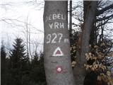 | Lesično - Debeli vrh (Bohor)
Debeli vrh is a 921-metre-high peak on Bohor between Veliki Koprivnik and Oslice. It is overgrown with dense forest, so there are no views. There...
1 h 45 min |
 | Lesično - Brest (Bohor)
Brest is a peak on Bohor although it loks more like a saddle. It is an important intersection of the Bohor trails. It lies between Oslica, which ...
1 h 30 min |
 | Kozje - Brest (Bohor) (via Vetrnik)
Brest is a peak on Bohor although it loks more like a saddle. It is an important intersection of the Bohor trails. It lies between Oslica, which ...
2 h |
 | Štore - Veliki vrh above Svetina (via Marija and over Svetina)
Veliki vrh is located south-west of Svetina above Štorá. It is inhabited mainly from the south and one of the homesteads is directly below the pe...
2 h 30 min |
 | Štore - Veliki vrh above Svetina (via Žlajfa and via Svetina)
Veliki vrh is located south-west of Svetina above Štorá. It is inhabited mainly from the south and one of the homesteads is directly below the pe...
2 h 15 min |
 | Štore - Veliki vrh above Svetina (through Bojanski graben and over Svetina)
Veliki vrh is located south-west of Svetina above Štorá. It is inhabited mainly from the south and one of the homesteads is directly below the pe...
2 h 30 min |
 | Studenice - Plešivec (at Boč)
Peace, silence, rugged terrain... the characteristics of a peak at the "crossroads" of many routes between the Maribor, Celje and Ptuj areas. Ple...
2 h |
 | Studenice - Plešivec (at Boč) (final part on forest road)
Peace, silence, rugged terrain... the characteristics of a peak at the "crossroads" of many routes between the Maribor, Celje and Ptuj areas. Ple...
2 h |
 | Podvelka - Hlebov vrh (Rdeči Breg) (via Viltužnik)
The Red Bank stretches between the Radoljna Gorge in the east, the Drava River in the north and the Velka Stream in the east. It is separated fro...
2 h |
 | Zidani Most - Sveta Marija (Ključevica)
The Church of St Mary is located on a hill called Ključevica, which rises 1067 metres above sea level. From the top, which is partly covered with...
2 h 30 min |
 | Zia - Dikeos (Kos)
Dikeos (846 m) is the highest mountain on the Kos island, the third-largest Dodecanese island in the southeastern Aegean sea in Greece (after Rho...
1 h 50 min |
 | HE Ožbalt - Klančnik (Glančnik)
Klančnik, also known as Glančnik on some maps, is an 877-metre-high peak located above the right bank of the Drava River, just a few minutes away...
2 h 10 min |
 | Podvelka - Klančnik (Glančnik) (via Sveti Ignacij)
Klančnik, also known as Glančnik on some maps, is an 877-metre-high peak located above the right bank of the Drava River, just a few minutes away...
2 h 30 min |
 | Selnica ob Dravi - Kranjčeva pečina
...
2 h 10 min |
 | Prebold - Strtnik (Strnik) (via Tolsti vrh)
...
1 h 55 min |
 | Trbovlje - Homič
...
2 h 15 min |
 | Žabče (road to Tolminske Ravne) - Poloje
...
2 h |